News
| Title | Description | Image | Action | ||
|---|---|---|---|---|---|
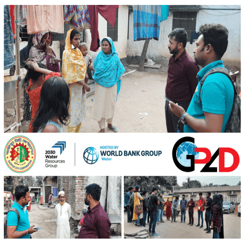
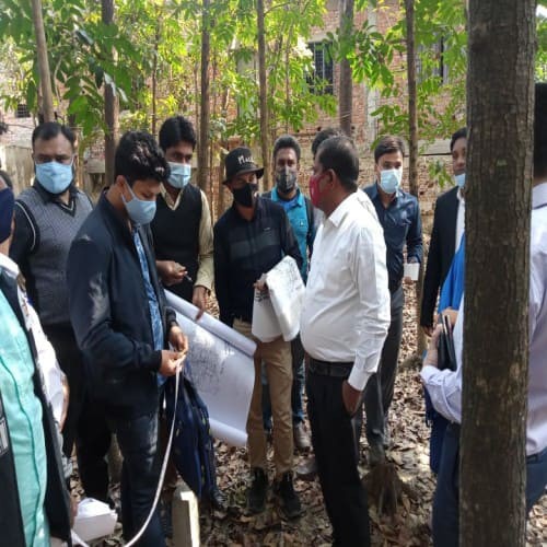
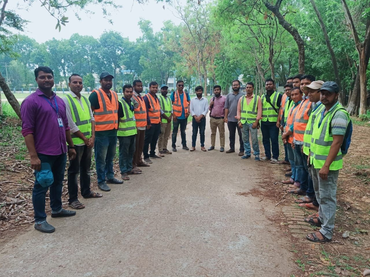
| Field Visit And Field Team Meeting At Gazipur | GPAD team working under Development of Integrated Wastewater Management System for Gazipur City Corporation (GCC). The main objective of this assignment is to collect and provide the GIS-based data related to sanitation, buildings, drain and roads for Zones 1(Tongi) and 4 (Gazipur) of GCC, to enable the development of the IMIS in the city; and strengthen the capacity of the city authorities to manage and plan sanitation services. |
 |
|||
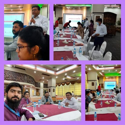
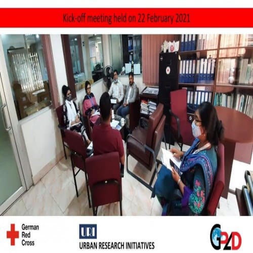
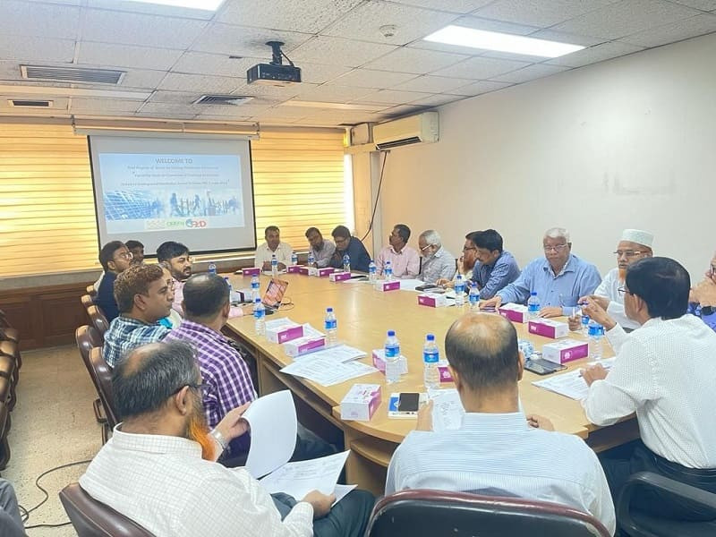
| Workshop With Deeper Consortium Partners | A half day Consultation workshop has been done with GRC and DEEPER Consortium Partners on 02 March 2021 at Hotel 71 in Dhaka. Consortium partners are German Red Cross, British Red Cross, International Federation of Red Cross, Action Against Hunger and Christian AID. Urban Research Initiative ( URI ) and Geo-Planning for Advanced Development (GPAD) working with the consortium members to develop a training manual for Multi Hazard Training Manual for the Ward Disaster Management Committee ( WDMC). |
 |
|||
| Field Visit Of Dhaka Ashulia Elevated Expressway | Dhaka Ashulia Elevated Expressway (DAEE) team visited the project site on 03 March 2021 along with the Chinese contractor, resettlement and land acquisition consultant CCDB and GPAD. Project Director Engr. Shahabuddin Khan lead the field team. |
 |
|||
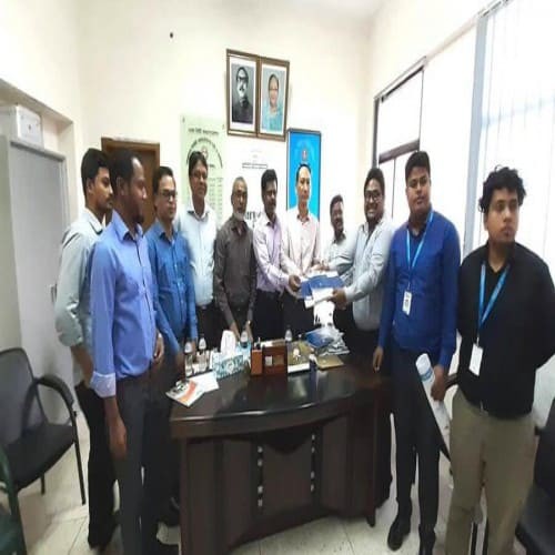
| Meeting with Land Acquisition department, Dhaka DC Office | Meeting with the Land Acquisition Department, Dhaka DC office. Meeting held on 9 March 2021. GPAD team working with 24 Engineering Bigrade, Bangladesh Army and Capital Development Authrity (RAJUK) under Excavation and Development of 100 ft Canels Poject at Purbachal. There are three khals will be developed to runoff the surface water of the surrounding area including Purbachal New Town area of Dhaka. |
 |
|||
| GRC, URI and GPAD has bees done Ward Level Meeting | German Red Cross (GRC), Urban Research Initiatives (URI) and Geo-Planning for Advanced Development (GPAD) has been done the consultation meeting with Ward Disaster Management Committee (WDMC) on 03 March 2021. Team Leaded Mr. Anisur Rahman conducted the meeting session in Ward no 36 and 47 of Dhaka South City Corporation (DSCC). |
 |
|||
| Field verification with DC Official, RHD Official and CCDB Officials | A joint field verification has been completed on 22 Feb 2022 at Chakaria Upazila, Cox's Bazar for the Matarbari Port Development Project (RHD Part). During the field visit and verification DC officials, RHD Officials and CCDB field office officials were present. |
 |
|||
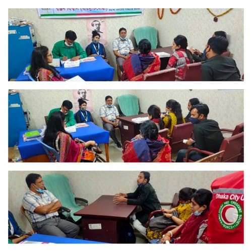
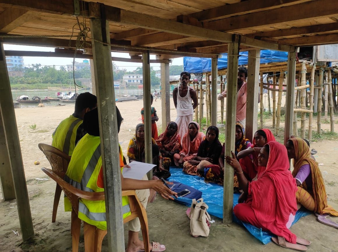
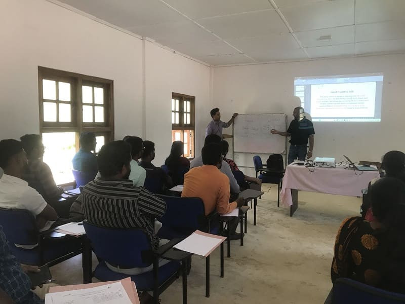
| Community Disaster Readiness Assessments for the Enhancing Community preparedness in Bangladesh: Coastal Disaster Risk Reduction Program. | Bangladesh Red Crescent Society recently commissioned Geo Planning for Advanced Development (GPAD) to conduct a study on the community and school disaster readiness assessment. The study aims to promote better understanding and analysis in terms of community and school preparedness towards natural hazardous events and disasters. This will be accomplished through examining community-level preparedness in four key areas, namely self-organization, ability to take action, knowledge and awareness, and connectivity. The purpose of the assessment is to enable identification and understanding of the level of preparedness of communities for natural hazards, specifically in terms of their self-organization, ability to take action, knowledge and awareness, and connectivity. The study will take place in and around Bagerhat (Sarankhola sub-district), Khulna (Paikgachha subdistrict), and Patuakhali (Kalapara sub-district). The studies will utilize qualitative and quantitative approaches, adapted to the local context, and will directly benefit organizations like the Bangladesh Red Crescent Society (BDRCS), Cyclone Preparedness Programme (CPP), IFRC, American Red Cross, Movement Partners, and Donors. |
 |
|||
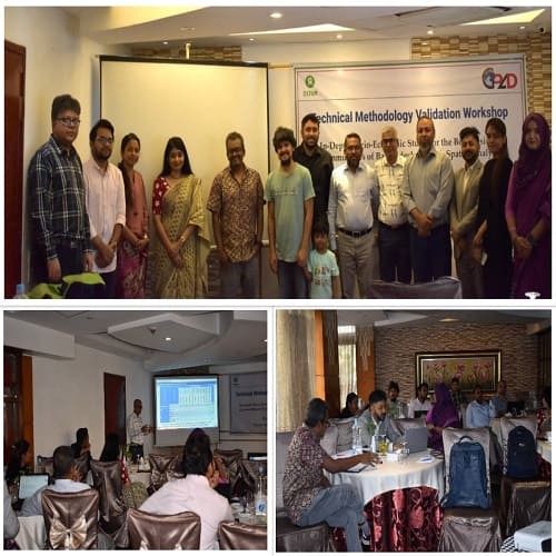
| Technical Methodology Validation Workshop | In Bangladesh, the Bede (snake charmers) or ‘Manta’ communities have made their boat homes since they have no land and rights to land to call their own. They are also denied access to essential living services like education, safe water and sanitation and their rights over the shared pool of resources. The government and non-government organizations have provided limited humanitarian or development assistance. A Coordinated effort is desperately required to improve the living environment of Bangladesh’s boat resident communities. Oxfam Bangladesh and its partners are working on outlining the resilience of the Boat Resident Community (BRC) in different zones of the country. While working, Oxfam hardly found any evidential documents or integrated databases that could interpret the BR community’s existing situation regarding residence patterns, livelihood patterns, access to education, health, gender equality, and rights over the common resource pool. The community is based in different parts, especially in the hard-to-reach area or in the most climate-vulnerable zones, 11 Upazilas of 5 Districts (Bhola, Patuakhali, Barguna, Laxmipur, Barisal, Noakhali and Chandpur). The climate impacts to the community’s life and living in resilience building are yet to be studied. Considering the fact, Oxfam reveals the inevitability of developing an evidential document. However, Geo Planning for Advance Development is working as a study team with Oxfam to develop an evidential document to understand the existing socio-economic status and the impact of climate-induced vulnerabilities, which are the primary barriers to ensuring community resilience. In this connection, 11 March 2023, Saturday, a consultation workshop titled “Technical Methodology Validation Workshop” has organized by Geo Planning for Advance Development (GPAD) with Oxfam and partners at Hotel Bengal Canary Park, Gulshan 1, Dhaka 1212, Bangladesh. Moreover, the presented guest believes that by “In-Depth Socio-Economic Study for the Boat Resident Communities of Bangladesh through Spatial Analysis” will able to develop an evidential document. This evidential document will source desegrated data regarding gender identity, social cast, and living zone, as well as can further guide to identify the priority for the community. |
 |
|||
| FINAL DISSEMINATION WORKSHOP ON “GIS MAPPING OF LICS ON DHAKA SOUTH CITY CORPORATION, ZONE-04” | FINAL DISSEMINATION WORKSHOP ON “GIS MAPPING OF LICS ON DHAKA SOUTH CITY CORPORATION, ZONE-04” |
 |
|||
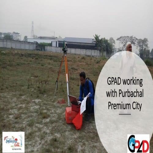
| We are working with Purbachal Premium City | We are working with Purbachal Premium City for their housing master plan design, field demarcation, and project implementation. Date: 19 February 2021 |
 |
|||
| GPAD working on a project for Training Manual Development | The objective of the assessment is to Develop a Training Manual for the Ward Disaster Management Committee (WDMC) of Dhaka South City Corporation; Client - German Red Cross (GRC) and Our Partner - Urban Research Initiative (URI) |
 |
|||
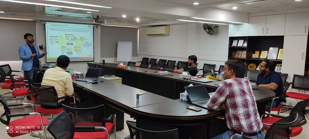
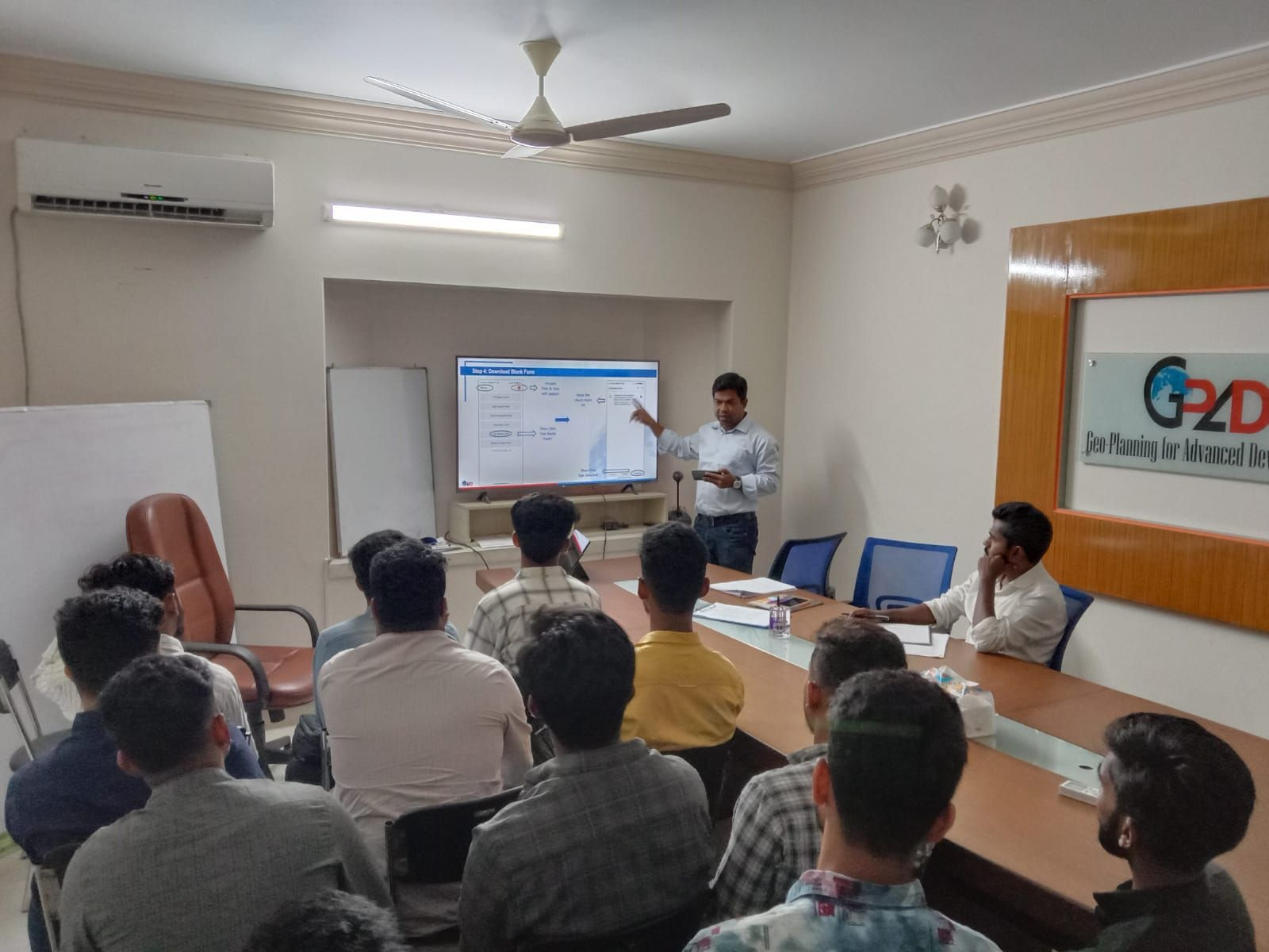
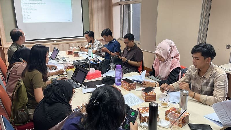
| Corporate training on Geographic Information System (GIS) for Development Professionals | GPAD conducted corporate training (03rd April to 8th April 2023) on QGIS (Quantum Geographic Information System) for Practical Action, a non-profit organization dedicated to providing practical and sustainable solutions to poverty in developing countries. The training aimed to equip the participants with essential knowledge and skills required for working with QGIS software for their project work. The training program was conducted by expert trainers from GPAD Bangladesh, who have vast experience in working with QGIS software in various projects. The trainers delivered the training in an interactive manner, where participants were encouraged to ask questions and seek clarification on any doubts. The QGIS training program covered various topics such as basic GIS concepts, data types, vector and raster data, spatial analysis, creating maps, and symbology. The participants were also taught about various plugins that can be used to enhance the functionality of QGIS software. The training was a mix of theoretical and practical sessions, where the participants were given hands-on experience of working with QGIS software. The participants were given real-life case studies and data sets to work with, which helped them to understand the practical applications of QGIS software. The training program was conducted over a period of five days and was attended by around five participants from Practical Action. The feedback from the participants was overwhelmingly positive, and they expressed their satisfaction with the quality of the training program. Overall, the QGIS training program conducted by GPAD Bangladesh was a great success, and it helped the participants to acquire essential skills required for working with QGIS software. The training program was a great example of how organizations can collaborate and share their expertise to create a positive impact in the society. |
 |
|||
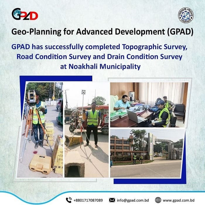
| GPAD has successfully completed Topographic Survey, Road Condition Survey, and Drain Condition Survey at Noakhali Municipality. | GPAD has completed an engineering survey (Including topographic, road condition, and drain condition surveys) at Noakhali Municipality. |
 |
|||
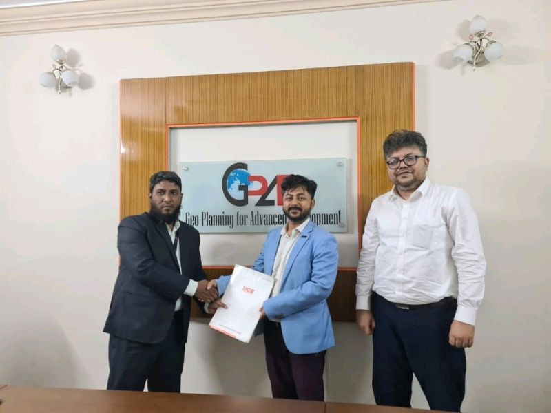
| agreement with United Commercial Bank Limited | GPAD signed an agreement with United Commercial Bank Limited for corporate banking services. |
 |
|||
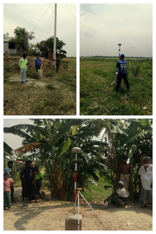
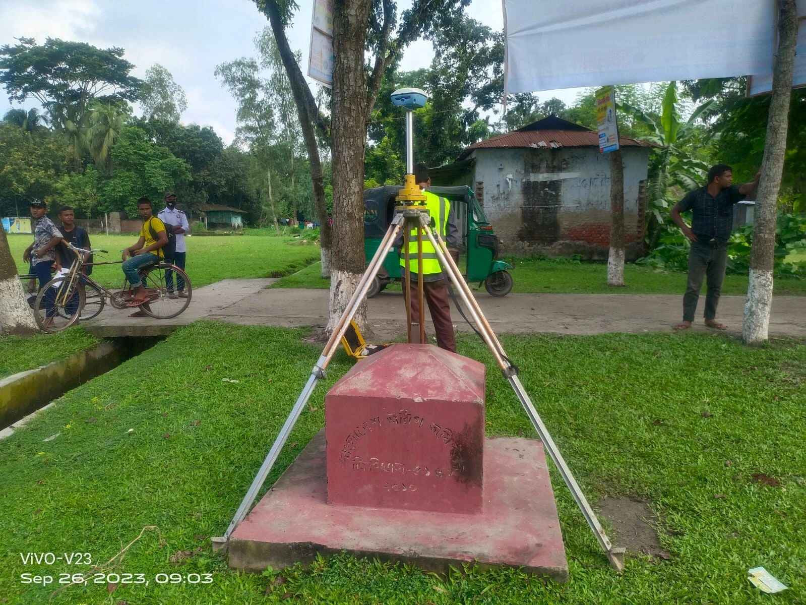
| GPAD is conducting GNSS survey to establish Temporary Bench Mark (TBM) in the aspect of the Survey of Bangladesh reference point for an Economic Zone at Nilkamal, Chandpur | GPAD is conducting GNSS survey to establish Temporary Bench Mark (TBM) in the aspect of the Survey of Bangladesh reference point for an Economic Zone at Nilkamal, Chandpur. GNSS (Global Navigation Satellite System) survey is a type of surveying technique that uses satellite signals to determine the precise location and coordinates of a point on the earth's surface. GNSS surveying is commonly used in a variety of applications, including construction, land surveying, mapping, and geodetic surveying. |
 |
|||
| GPAD team conducting indepth socio economic study on the Boat Resident Community in Bangladesh | GPAD team conducting indepth socio economic study on the Boat Resident Community in Bangladesh |
 |
|||
| GPAD Team conducting an electric asset survey for Dhaka Palli Bidyut Samity 1. | We are conducting an electric asset survey for Dhaka Palli Bidyut Samity 1. This survey is being done as part of a feasibility study for the design of an underground distribution network and the preparation of a master plan. |
 |
|||
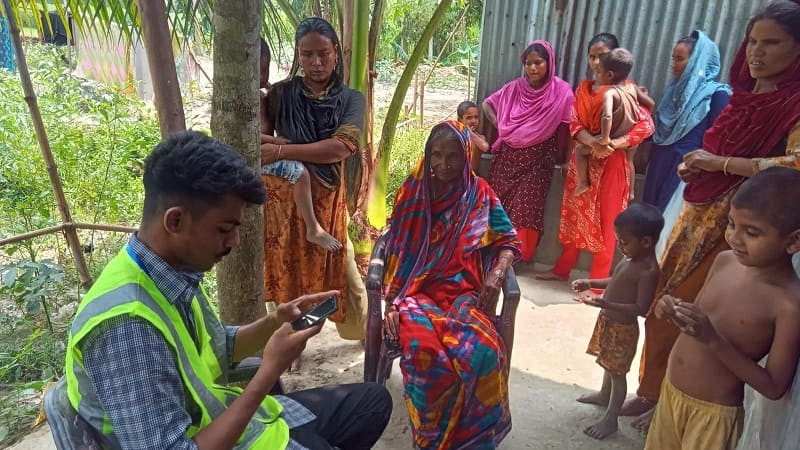
| GPAD conducted a comprehensive training session with enumerators to conduct the baseline and endline for field survey which will be useful for assessment status of ANTICIPATION project. | we conducted a comprehensive training session with enumerators to conduct the baseline and endline for field survey which will be useful for assessment status of ANTICIPATION project. This vital project aims to enhance the preparedness and response to future challenges, ensuring proactive measures that are taken for the well-being of communities across Asia ( Bangladesh, Indonesia, Mongolia, Myanmar, Philippines and Sri Lanka). Together, we're shaping a resilient future through data-driven insights and anticipatory actions." |
 |
|||
| GPAD team is working with OCG to do a topographic survey of 800 km Railway Alignment in Bangladesh. | GPAD is involved in a #topographic survey for Bangladesh Railway. Topographic surveys are essential for infrastructure development projects like railways, as they provide detailed information about the physical features of the land, including its elevation, contours, and other natural and man-made features. GPAD will use modern survey equipment including #gnss #drones to do the survey. |
 |
|||
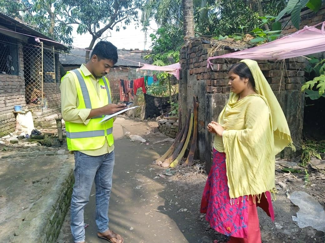
| Baseline Survey of Anticipatory Action Project is ongoing in Six countries including Bangladesh, Myanmar, Sri Lanka, Mongolia, Philippines and Indonesia. | GPAD Bangladesh team conducting a socio-economic survey of a vulnerable community with funding from World Vision International demonstrates a commitment to understanding and addressing the needs of marginalized populations. Conducting such surveys helps gather valuable data and insights that can inform the development of targeted interventions and programs to support vulnerable communities. |
 |
|||
| GPAD awarded a new project to develop IEC documents on climate change and disaster issues, funded by CCDB. | We are thrilled to announce that GPAD had the pleasure of meeting with the esteemed Christian Commission for Development in Bangladesh (CCDB). Our discussion centered around an important initiative, the Strengthening Emergency Preparedness and building infrastructure for Disaster Vulnerable Communities in Bangladesh (STEP&BuildIn) project. |
 |
|||
| Exciting times as we completed the training of Enumerators in Jakarta, Indonesia for Geo-Planning for Advanced Development (GPAD)'s international project with World Vision International. | We are conducting Anticipatory Action Research using KoBo Collect survey tools across six countries in Asia. Grateful for the opportunity to contribute to data-driven development initiatives in Bangladesh, Indonesia, Mongolia, Myanmar, Philippines, and Sri Lanka. Thanks to our dedicated team for their commitment. Looking forward to the positive impact this project will bring. |
 |
|||
| Thrilled to announce the successful completion of the enumerator training program conducted by Geo-Planning for Advanced Development (GPAD) in Sri Lanka at the Green Hills Hotel, Hatton. | As part of the Anticipatory Action Research project, GPAD is conducting Baseline and Endline Surveys in six countries across Asia, including Sri Lanka, for World Vision International. The training equipped our enumerators with the necessary skills and tools to carry out data collection effectively. They received comprehensive training on survey methodologies, ethical considerations, and the utilization of survey tools such as KoBo Collect. We are confident that our well-trained enumerators will play a crucial role in gathering valuable insights for this important research initiative. |
 |
|||
| A progress meeting was held on June 14th, 2023 for the project "Consultancy Services for Feasibility Study to Establish an Underground Distribution Network by Replacing the Existing Overhead Distribution Network Under Dhaka Palli Bidyut Samity-1. | A progress meeting was held on June 14th, 2023 for the project "Consultancy Services for Feasibility Study to Establish an Underground Distribution Network by Replacing the Existing Overhead Distribution Network Under Dhaka Palli Bidyut Samity-1." Key stakeholders from the Bangladesh Rural Electrification Board (BREB) included the Additional Chief Engineer, Director, Technical, SE (Gen), Director, SE&D, Director I&T, Director MPSS, SE Environment & Social Management, Director, MPSS, SE, GIS, SE, Grid and SS, and Senior System Analyst (ICT). Representatives from Dhaka Palli Bidyut Samity-1 included the GM and DGM (T). The meeting highlighted the project's progress, fostering collaborative discussions to enhance electricity distribution in Dhaka Palli Bidyut Samity-1. This meeting signifies a powerful partnership aimed at revolutionizing the distribution network. The joint efforts of the BREB, Dhaka PBS-1, GPAD, PRDC India, and GISL will pave the way for an optimized underground system, bolstering the efficiency and reliability of electricity distribution in Dhaka Palli Bidyut Samity-1. |
 |
|||
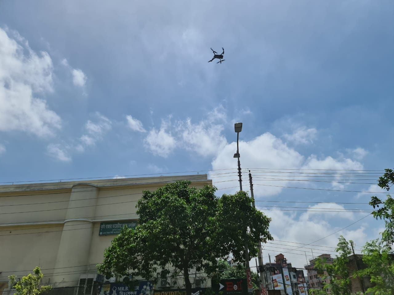
| Geo-Planning for Advanced Development (GPAD) is actively engaged in an impactful survey in collaboration with the Dhaka North City Corporation (DNCC) | Geo-Planning for Advanced Development (GPAD) is actively engaged in an impactful survey in collaboration with the Dhaka North City Corporation (DNCC). Using advanced drone technology, we are focused on identifying mosquito breeding sites in rooftop gardens and pooled water areas within the DNCC jurisdiction. These efforts aim to combat the proliferation of the Aedes species known for transmitting diseases like dengue. |
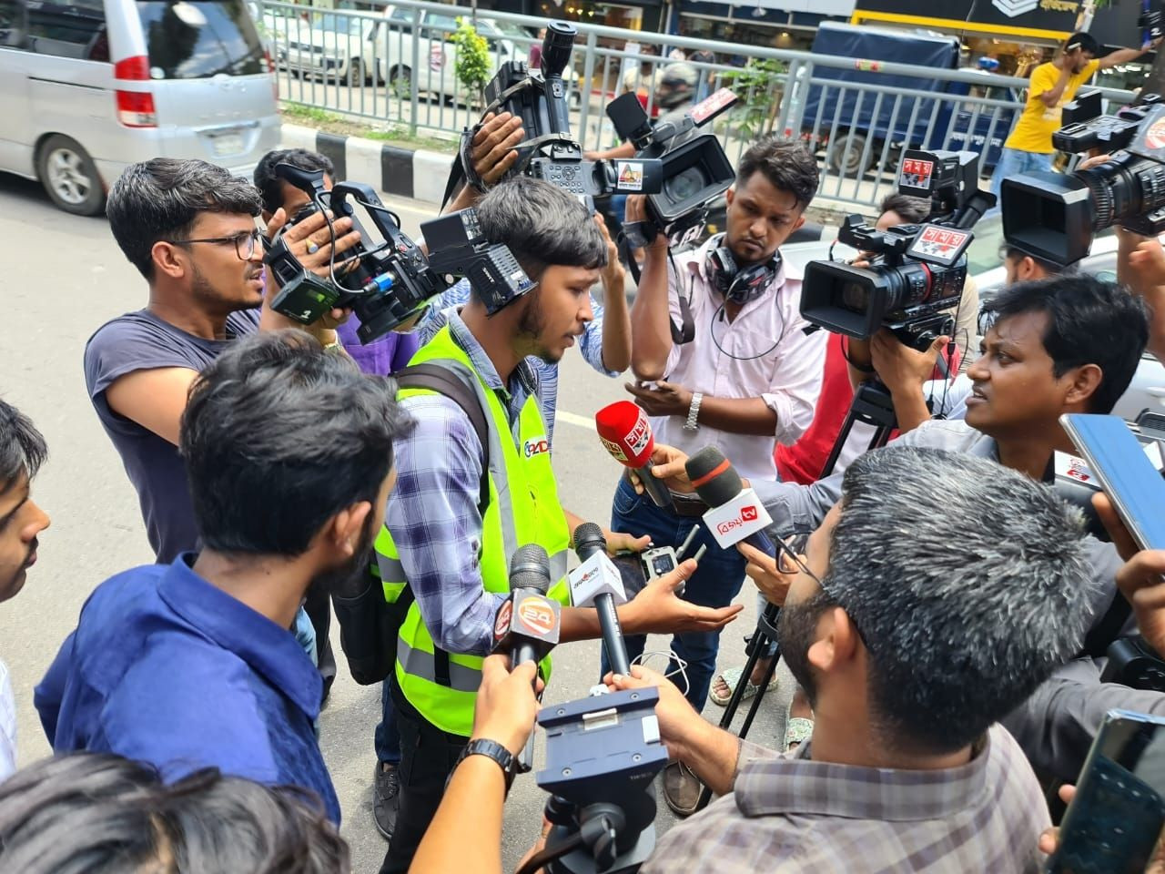 |
|||
| ডিএনসিসি এলাকার ভবনের ছাদ মনিটরিংয়ে ড্রোনের ব্যবহারের কাজ করছে জিও প্ল্যানিং ফর অ্যাডভান্সড ডেভেলপমেন্ট (জিপ্যাড)। | এই সংস্থার ব্যবস্থাপনা পরিচালক মো. রেজাউর রহমান দেশ রূপান্তরকে বলেন, ডিএনসিসি মশার প্রজনন কার্যক্রম মনিটরিংয়ে আধুনিক প্রযুক্তি গ্রহণ করছে। এই ড্রোনের মাধ্যমে দুটো বড় সমস্যার সমাধান করা যায়। প্রথমত, বহুতল অনেক ভবনের ছাদে ওঠা মশককর্মীদের জন্য কষ্টসাধ্য ব্যাপার। দি¦তীয়ত, অনেক ভবনমালিক কর্মীদের বাসার ছাদে উঠতে দিতে চান না। ড্রোন প্রযুক্তির ব্যবহারের ফলে এই সমস্যার সমাধান মিলছে। |
 |
|||
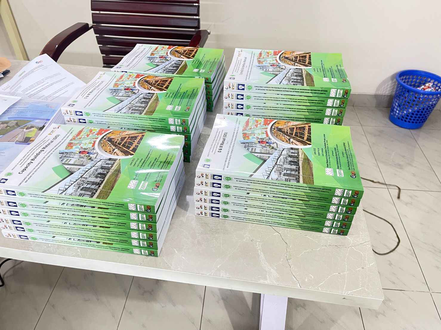
| Deliverables are ready to submit! | Operation and Maintenance Manual and |
 |
|||
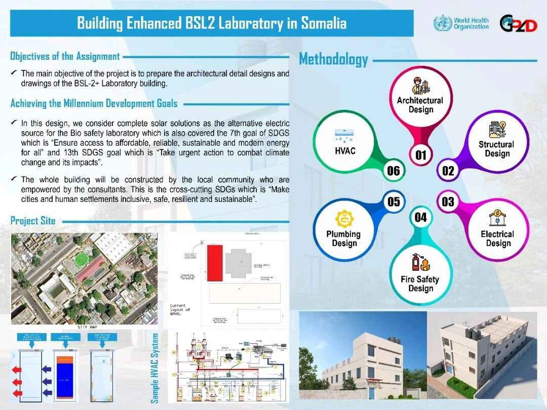
| GPAD has marked a milestone by spearheading the creation of a Biosafety Level 2 (BSL2) laboratory in Somalia | GPAD has marked a milestone by spearheading the creation of a Biosafety Level 2 (BSL2) laboratory in Somalia. The lab's comprehensive design, covering architectural, structural, electrical, and plumbing aspects, underscores GPAD's commitment to advancing healthcare infrastructure. Funded by the World Health Organization (WHO), this endeavor stands as a remarkable example of international collaboration. |
 |
|||
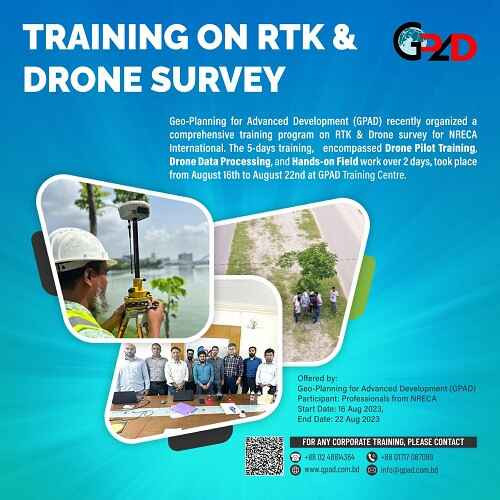
| We are thrilled to announce the successful completion of a comprehensive capacity-building training and immersive hands-on session conducted by Geo-Planning for Advanced Development (GPAD) Ltd for the NRECA International team! | In an effort to foster growth and expertise within the energy sector, GPAD had the privilege of sharing its knowledge and experience on working with modern survey tools including RTK Drones with the NRECA International team. The training focused on equipping participants with cutting-edge insights, industry best practices, and practical skills that are crucial in today's dynamic landscape. |
 |
|||
| GPAD has successful completed another fruitful GIS training session at our GPAD Office. | GPAD has successful completed another fruitful GIS training session at our GPAD Office. This batch was enriched by the participation of eight talented individuals from BCL Associates Ltd. |
 |
|||
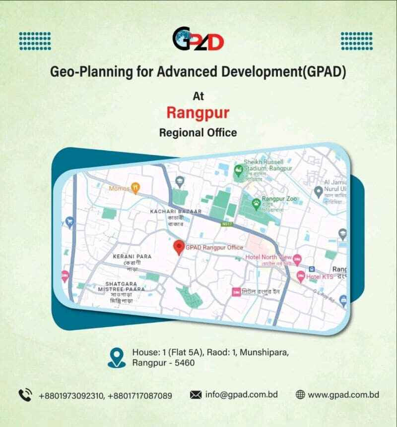
| GPAD Expands with a New Regional Office in Rangpur! | GPAD has taken a big step forward in its mission to serve our clients better and expand our reach. Starting from September 2023, we have officially opened our Regional Office in Rangpur, bringing our expertise closer to the heart of Northern Bangladesh. At GPAD Rangpur, we are dedicated to delivering top-notch services to meet the growing demands of our clients. Here's a glimpse of the diverse range of activities and services we are all set to offer: Feasibility Study: We're committed to helping businesses make informed decisions. Our team will conduct in-depth feasibility studies to guide your ventures towards success. |
 |
|||
| GPAD started one of our exclusive Corporate GIS Training Program tailored for professionals. | We're delighted to welcome eight talented participants from BCL Associates Limited. as they embark on this enriching journey to expand their Geographic Information Systems (GIS) expertise. |
 |
|||
| Bhairab to Mymensingh under RCIPF Project. | GPAD conducting RTK (Static) Survey for Bangladesh Railway at Bhairab, Kishoreganj District. |
 |
|||
| Bangladesh Railway feasibility study design | Field visit with Bangladesh Railway, OCG, EGS, HSS team. Sub Project 6 under Railway Connectivity Improvement Preparatory Facility Project (RCIPF). |
 |
|||
| Happy World Habitat Day! | GPAD celebrate our shared responsibility for the future of our homes and communities. As we strive for a more sustainable and inclusive world, let's reflect on the importance of safe, affordable, and environmentally friendly housing for all. |
 |
|||
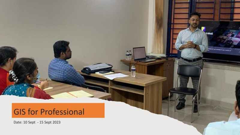
| GIS Professional Development | GPAD successfully concluded another GIS for Professionals course this month. We were honored to have Ms. Trudy R. Ganendra, Managing Director of Ground Data Solutions R&D Sdn Bhd, a leading LiDAR data acquisition company in Malaysia, as our special guest. Ms. Ganendra presented the training certificates to the participants of the GIS Training Course.
|
 |
|||
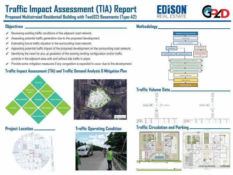
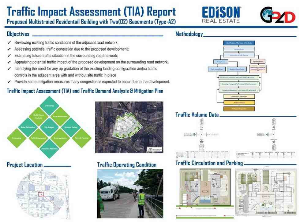
| Transportation Planning GPAD(Traffic Impact Assessment) | GPAD has successfully conducted a comprehensive Traffic Impact Assessment (TIA), showcasing our expertise in the field of traffic analysis and planning. Our commitment to delivering high-quality solutions in the realm of transportation and infrastructure shines through this project. |
 |
|||
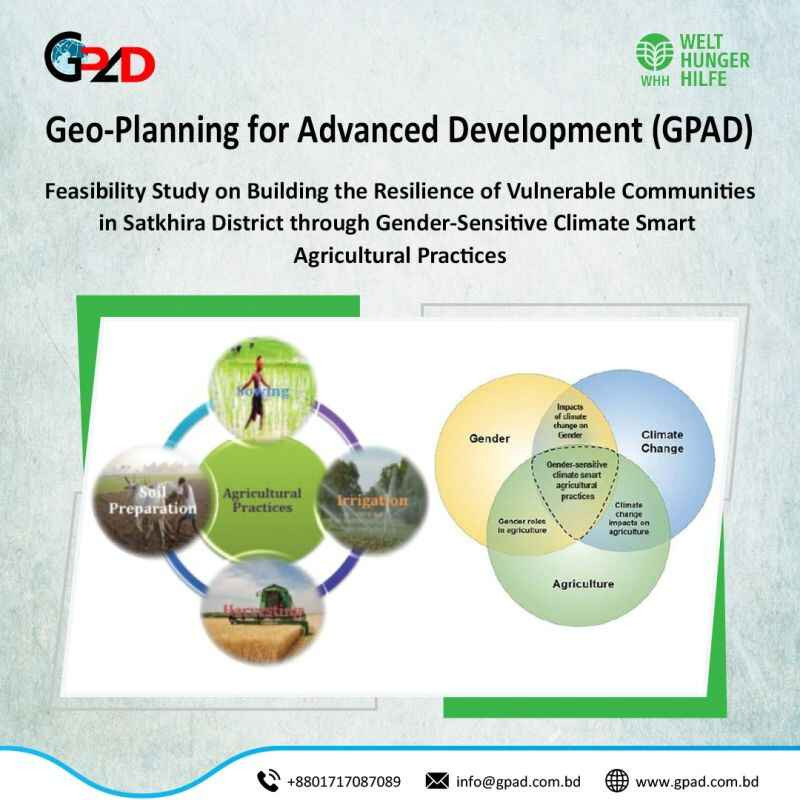
| Climate Smart Agriculture Practices | GPAD has been honored with a project entitled 'Conducting a Feasibility Study for Enhancing the Resilience of Vulnerable Communities in Satkhira District through Gender-Sensitive Climate-Smart Agricultural Practices.' This endeavor is made possible through the generous funding support of Deutsche Welthungerhilfe. |
 |
|||
| Climate Smart Agri Community Development | GPAD team is currently conducting a feasibility study aimed at bolstering the resilience of vulnerable communities in Satkhira District through gender-sensitive, climate-smart agricultural practices. Grateful for the generous funding support from Deutsche Welthungerhilfe e.V. as we embark on this impactful journey. |
 |
|||
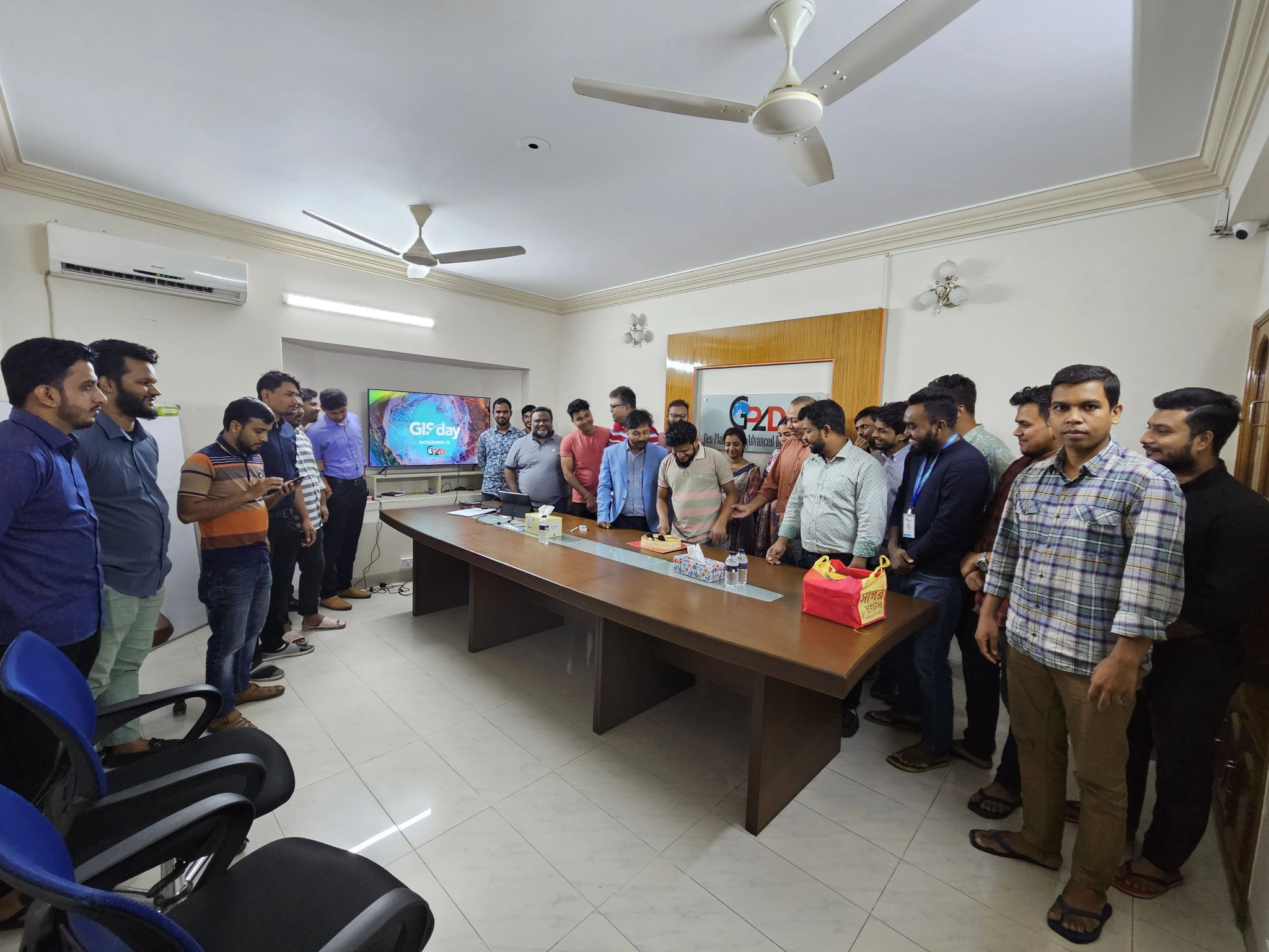
| GIS Day Innovation Location Intelligence | Exciting day at GPAD as we celebrated GIS Day 2023 at our Corporate Office! Embracing the power of Geographic Information Systems, we showcased innovation, collaboration, and the transformative impact of location intelligence. A big thanks to our dedicated team for making this event a success! |
 |
|||
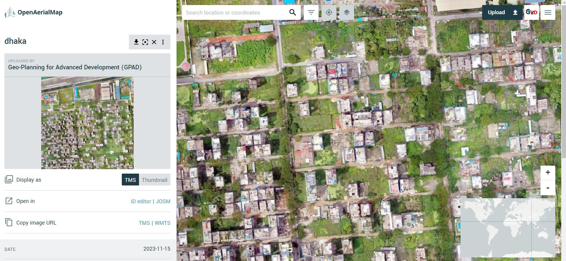
| Geo-Planning for Advanced Development (GPAD) Ltd | Anyone can get high-resolution drone images of Dhaka City from the following link. |
 |
|||
| Professional Development | GPAD successfully concluded another GIS for Professionals course this month. We were honored to have Ms. Trudy R. Ganendra, Managing Director of Ground Data Solutions R&D Sdn Bhd, a leading LiDAR data acquisition company in Malaysia, as our special guest. Ms. Ganendra presented the training certificates to the participants of the GIS Training Course. |
 |
|||
| Urban Resilience Project : RAJUK Part. | Huge thanks to Mr. Jun Matsuo for welcoming! GPAD is incredibly excited to be part of such a dynamic and innovative company like OYO International, and GPAD looking forward to collaborating with the talented team to achieve great things together. |
 |
|||
| Traffic Impact Assessment ,Transportation Planning | GPAD has successfully conducted a comprehensive Traffic Impact Assessment (TIA), showcasing our expertise in the field of traffic analysis and planning. Our commitment to delivering high-quality solutions in the realm of transportation and infrastructure shines through this project. If you find yourself in need of any traffic-related services, whether it's conducting Traffic Surveys or in-depth Studies, don't hesitate to reach out to us. With a dedicated team of experts and a track record of successful projects, we are well-equipped to tackle any transportation challenge. At GPAD, we prioritize understanding the intricate dynamics of traffic flow and its impact on various projects. We tailor our services to meet your specific needs, ensuring that your transportation goals are met efficiently and effectively. Let's collaborate and navigate the complex world of traffic planning together. Your success is our priority, and we're here to make it happen. Contact us for all your traffic-related needs. |
 |
|||
| Celebrate World Wildlife Day: Connecting People and Planet! | On March 3rd, we celebrate World Wildlife Day! This year's theme, "Connecting People and Planet: Exploring Digital Innovation in Wildlife Conservation," highlights the potential of technology to bridge the gap between humans and the natural world. |
 |
|||
| Thrilled to announce that GPAD has partnered with OCG on a new project | The project aims to equip these communities with robust disaster risk reduction plans (UzDRRPs) through: |
 |
|||
| Workshop on Understanding Local Hazards, Identifying DRR Issues and ... | The workshop brought together GPAD, DDM, JICA and OCG to collaboratively develop an action plan for Disaster Risk Reduction in Chilmari & Ulipur Upazila. |
 |
|||
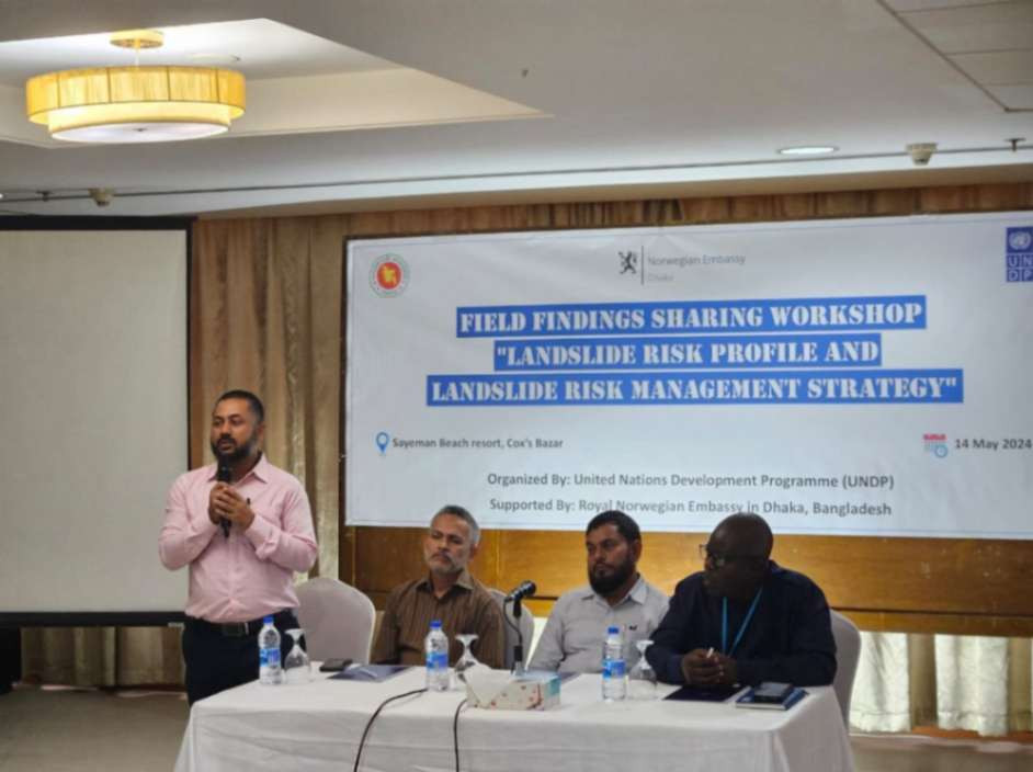
| Sharing Field Findings: Landslide Risk Profile and Management Strategy for Cox's Bazar | We're pleased to present the results of our landslide study in Cox's Bazar! This workshop will share key findings from our field investigations, including a comprehensive landslide inventory of approximately 400 locations. Additionally, we'll unveil a draft Landslide Risk Management Strategy specifically tailored for Cox's Bazar. |
 |
|||
| Our Managing Director, recently visited the Kolkata office of PRDC. | Rejaur Rahman, our Managing Director, recently visited the Kolkata office of Power Research and Development Consultants Pvt Ltd (PRDC), a leading international consulting firm specializing in power system studies and engineering services. PRDC has been a pioneer in their field for over 30 years and we have collaborated with them in Bangladesh for the past couple of years. |
 |
|||
| Upazila Sub-Committee Meetings at Chilmari, Kurigram | Facilitated successful 1st Upazila Sub-Committee Meetings at Chilmari, Kurigram, as part of the 'Capacity Enhancement on Formulation and Implementation of Local Disaster Risk Reduction Plan' project. |
 |
|||
| Initiation Workshop with the TLCC Members of Noahata Municipality, Rajshahi under the Improving Urban Governance & Infrastructure Program (IUGIP) Project, LGED. | JV of datEx, DevCon and Geo-Planning for Advanced Development (GPAD) Ltd successfully kicked off the Initiation Workshop with the TLCC Members of Noahata Municipality, Rajshahi under the Improving Urban Governance & Infrastructure Program (IUGIP) Project, LGED. We're thrilled to embark on this journey to develop a comprehensive Master Plan for the Municipality. |
 |
|||
| We welcomed the JICA Expert Team | Today, we welcomed the JICA Expert Team to our Chimari Office for a productive discussion on the ongoing Upazila Disaster Risk Reduction Action Plan Preparation project. We reviewed the project's progress and discussed next steps. |
 |
|||
| A joint venture between Data Experts (Pvt.) Limited [datEx], DevConsultants Limited (DevCon), and Geo-Planning for Advanced Development (GPAD) Ltd | October 7th, 2024, marks the official kickoff of the Master Plan Preparation under Improving Urban Governance & Infrastructure Program (IUGIP) project in Bangladesh! A joint venture between Data Experts (Pvt.) Limited [datEx], DevConsultants Limited (DevCon), and Geo-Planning for Advanced Development (GPAD) Ltd is proud to be leading the development of comprehensive Master Plans for 15 municipalities across the country. Funded by the Asian Development Bank (ADB), this initiative will create a blueprint for sustainable urban development, encompassing: We are excited to collaborate with the Local Government Engineering Department (LGED) and municipalities to build thriving and resilient urban spaces. hashtag#IUGIP hashtag#UrbanPlanning hashtag#MasterPlan hashtag#Bangladesh hashtag#LGED hashtag#datEx hashtag#DevCon hashtag#GPAD hashtag#ADB |
 |
|||
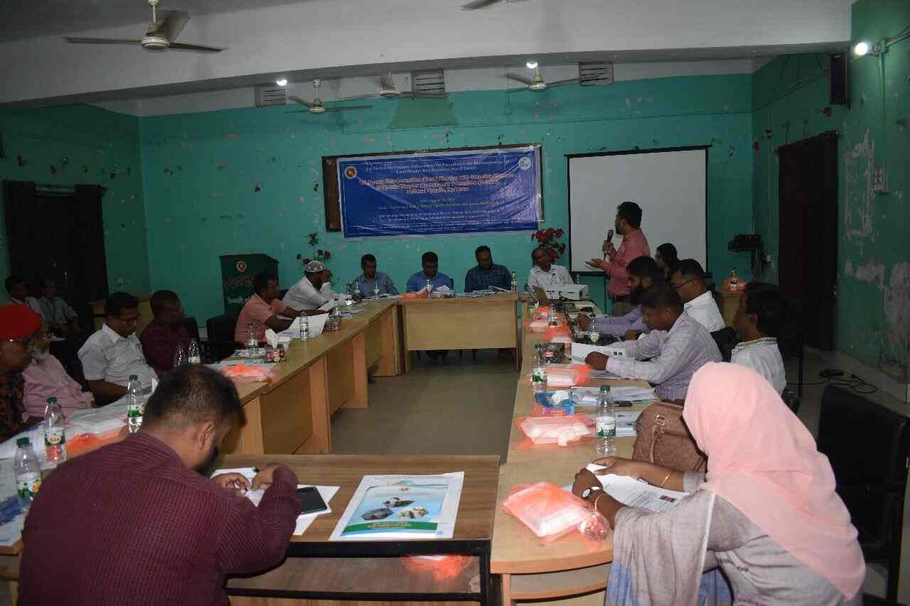
| Daylong Workshop on Scientific Multi-Hazard Risk Assessment & DRR Target Review and Revision of DRR Countermeasures took place on September 26, 2024, at the Upazila Parishad Auditorium, Ulipur Upazila, Kurigram. | This workshop was organized by the Department of Disaster Management (DDM) in collaboration with the Japan International Cooperation Agency (JICA) and Geo-Planning for Advanced Development (GPAD) Ltd. Key areas of focus included: - Understanding the findings of scientific multi-hazard risk assessments Workshops like these play a critical role in strengthening local resilience and preparedness in disaster-prone areas. hashtag#DisasterManagement hashtag#DRR hashtag#Resilience hashtag#RiskAssessment hashtag#DDM hashtag#Ulipur |
 |
|||
| Successful Completion of Training on OH to UG Network Feasibility Study | We are pleased to share that a joint venture of PRDC India, GISL Bangladesh, and GPAD Bangladesh successfully conducted a five-day training session on the Conversion of Overhead to Underground Network Feasibility Study under the Replacing Overhead Electric Lines to Underground project for Dhaka Palli Bidyut Samity 1. The training was attended by 10 participants from BREB and Dhaka PBS 1, who actively engaged in learning and discussions, contributing to the success of the program. A certificate distribution ceremony marked the conclusion of the training, where representatives from Power Research & Development Consultants Private Limited (PRDC) India, GISL Bangladesh, and Geo-Planning for Advanced Development (GPAD) Ltd Bangladesh were present to celebrate this milestone. |
 |
|||
| Started a 5-day training program on replacing overhead electric lines with underground lines in Dhaka Palli Biddyt Somity 1. | 20 October 2024, Power Research & Development Consultants Private Limited (PRDC), GISL, and Geo-Planning for Advanced Development (GPAD) Ltd have started a 5-day training program on replacing overhead electric lines with underground lines in Dhaka Palli Biddyt Somity 1. Our esteemed trainers, Debaroti Basu (PRDC Executive Director), Razu Ahmed (GISL Executive Director), and Rejaur Rahman, FBIP (GPAD Managing Director), will share their expertise and insights throughout the sessions. This initiative is a significant step towards improving safety and reliability of the power grid in Dhaka. |
 |
|||
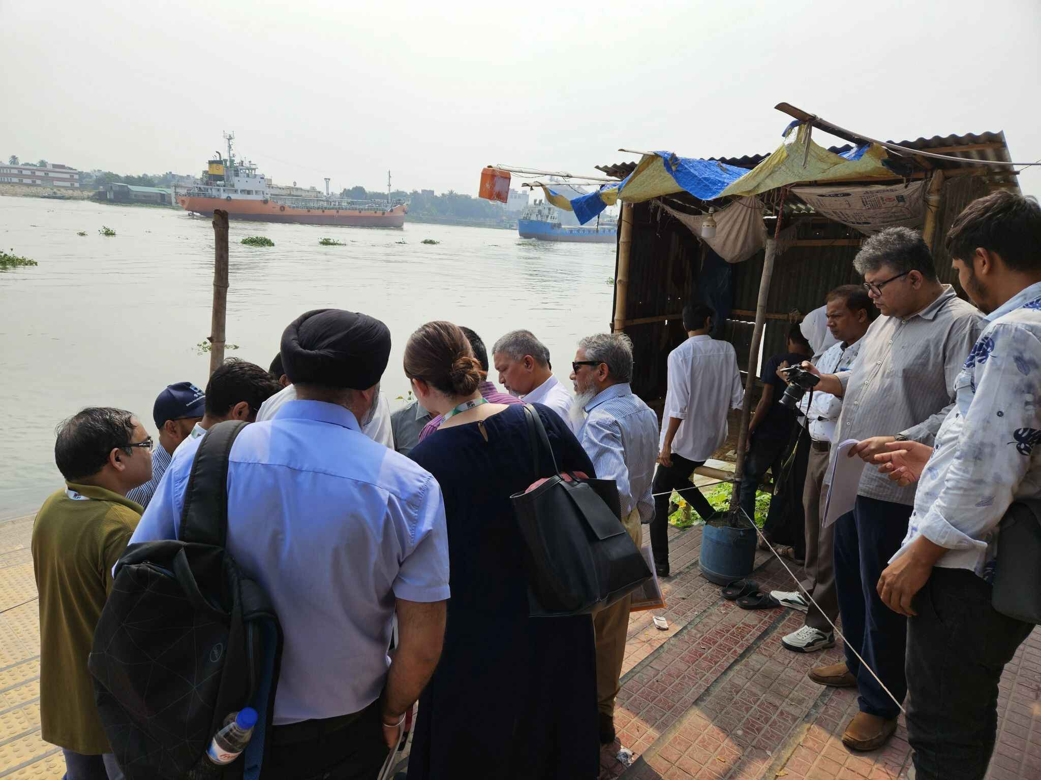
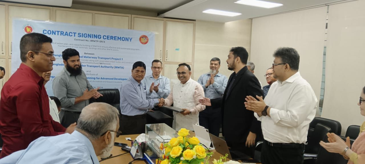
| Exciting Milestone in Bangladesh's Waterway Infrastructure! | Today marks the formal launch of an essential consultancy project with the Bangladesh Inland Water Transport Authority (BIWTA), as part of the Bangladesh Regional Waterway Transport Project 1. Through this collaboration, we aim to develop a comprehensive action plan and provide capacity-building initiatives to ensure sustainable, long-term maintenance of river terminals, landings, and other BIWTA assets. This ambitious project, backed by the World Bank under Credit No.: 5842-BD, will strengthen the Chattagram-Dhaka-Ashuganj IWT Corridor and its associated routes, fostering efficient inland water transport and elevating Bangladesh’s trade infrastructure. We are thrilled to bring together the expertise of Meinhardt Group (Singapore) Pte Ltd, Geo-Planning for Advanced Development (GPAD) Ltd, INTELIS Solution Ltd., and Life Institute and Research Academy. This joint venture combines international insights with local knowledge to deliver impactful solutions for Bangladesh's inland waterways. Here’s to making strides toward a resilient, sustainable future for Bangladesh’s waterway transport! |
 |
|||
| we conducted another Initiation Workshop on Master Plan Preparation with TLCC members and other representatives of Sundarganj Municipality | Today (19 November 2024), we conducted another Initiation Workshop on Master Plan Preparation with TLCC members and other representatives of Sundarganj Municipality, Gaibandha. This event is part of the Improving Urban Governance & Infrastructure Program (IUGIP) under the Local Government Engineering Department (LGED) The project is being implemented by the joint venture of Data Experts (Pvt.) Limited [datEx] DevConsultants Limited (DevCon) and Geo-Planning for Advanced Development (GPAD) Ltd. |
 |
|||
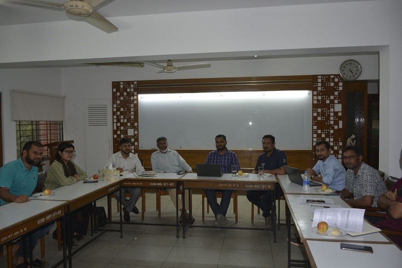
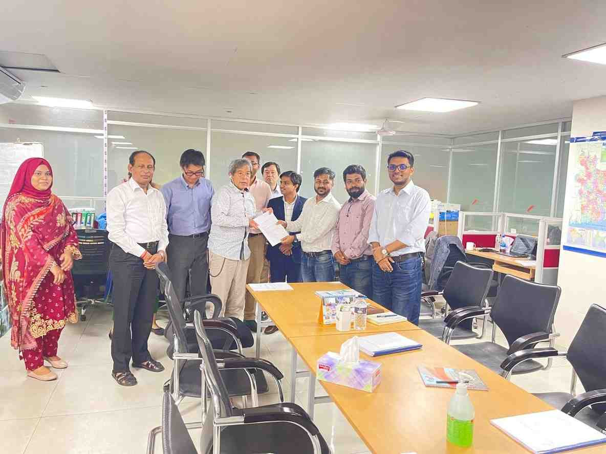
| Building Capacity for IMIS Development and Deployment in Bangladesh | Excited to share that we participated in the Technical Training on IMIS Development and Deployment under the Strengthening Public Data Systems for Sanitation in Bangladesh (SPDSSB) initiative. This impactful program is being implemented by DPHE, Government of Bangladesh, and is generously funded by the Bill & Melinda Gates Foundation. |
 |
|||
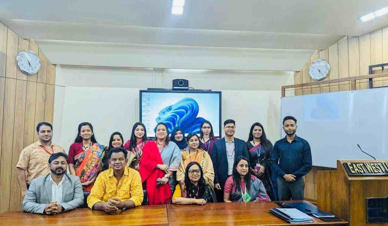
| Geo-Planning for Advanced Development (GPAD) Ltd is committed to continuing our partnership with EWU to create more opportunities for student learning and professional growth. | GPAD would like to extend our heartfelt thanks to the Department of Sociology, East West University (EWU) for inviting us to the Internship and Research Presentation on November 28, 2024. |
 |
|||
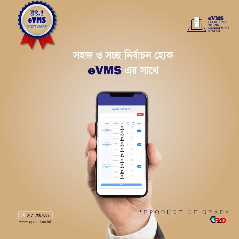
| স্মার্ট নির্বাচনের নতুন সম্ভাবনা উন্মোচনে আমাদের সঙ্গেই থাকুন। | Geo-Planning for Advanced Development (GPAD) Ltd নিয়ে এসেছে একটি আধুনিক, স্বয়ংক্রিয় ও নিরাপদ ই-ভোটিং ম্যানেজমেন্ট সিস্টেম (eVMS), যা যেকোনো প্রতিষ্ঠান বা সংস্থার নির্বাচন প্রক্রিয়াকে করবে সহজ, স্বচ্ছ এবং নির্ভরযোগ্য। ম্যানুয়াল ভোট গণনার ঝামেলা ভুলে যান – এখন লাইভ আপডেটের মাধ্যমে রিয়েল-টাইমে ফলাফল দেখুন এবং ভোটিং প্রক্রিয়াকে আরও গতিশীল করুন। ইনবক্স করুন অথবা কল করুন: |
 |
|||
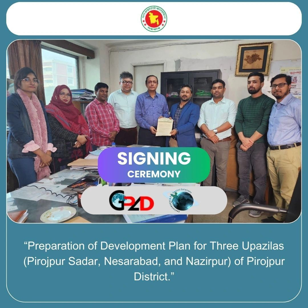
| Agreement with the Urban Development Directorate (UDD) | We are pleased to share that today we signed an agreement with the Urban Development Directorate (UDD) for the “Socio-Economic and Other Related Surveys” under the “Preparation of Development Plan for Three Upazilas (Pirojpur Sadar, Nesarabad, and Nazirpur) of Pirojpur District.” |
 |
|||
| Inception Workshop on Asset Management and Capacity | We are pleased to share the successful completion of the Inception Workshop for the study on the “Development of an Action Plan and Capacity Building of BIWTA to Ensure Effective and Sustainable Long-Term Maintenance of River Terminals, Landings, and Other BIWTA Assets.” Implemented by: Consultant Team (Joint Venture): Key Objectives of the Study: This World Bank-funded initiative marks a significant step towards sustainable water transport infrastructure and improved operational efficiency in Bangladesh. |
 |
|||
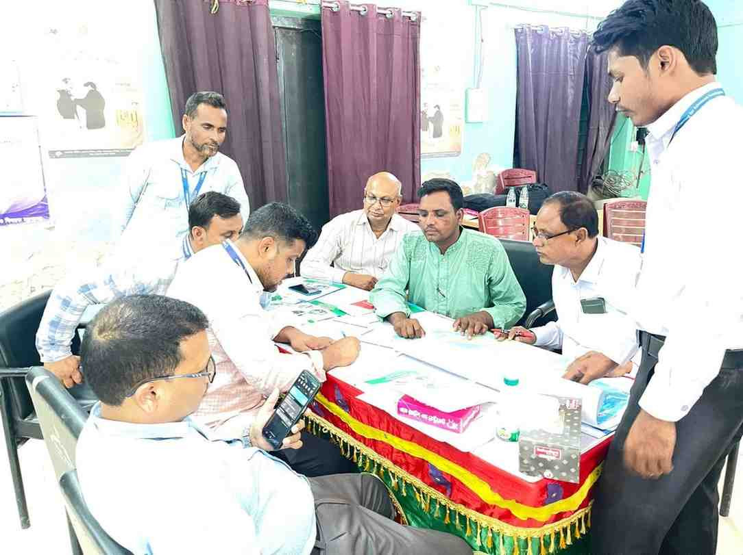
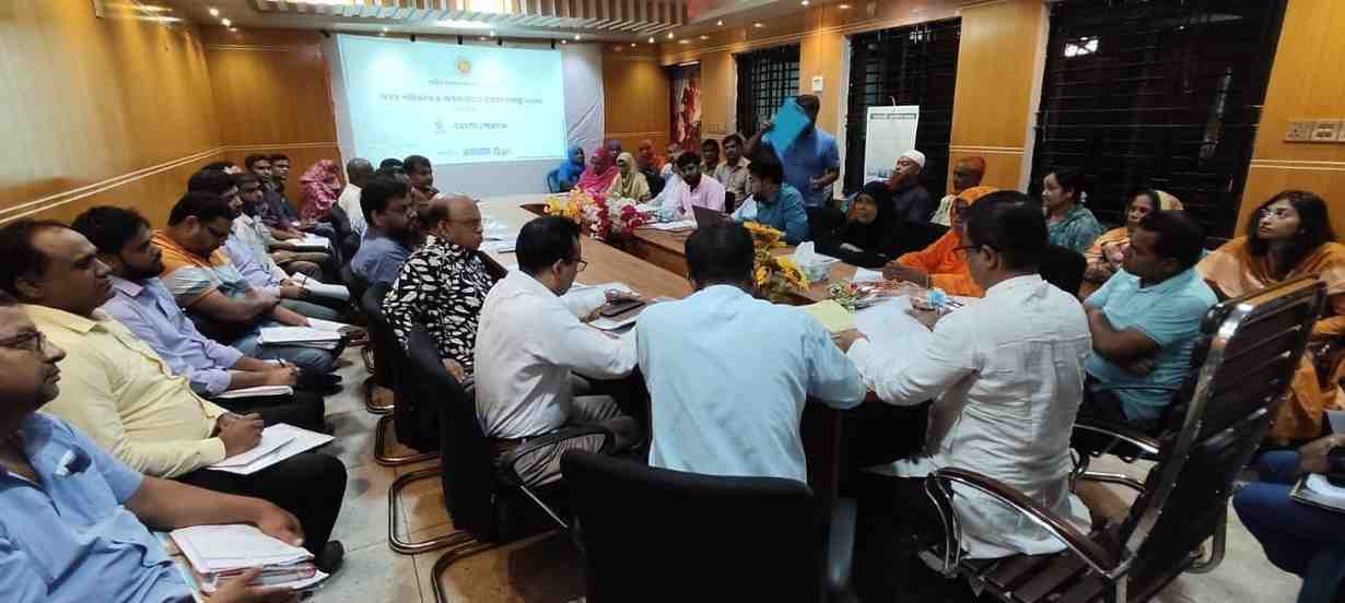
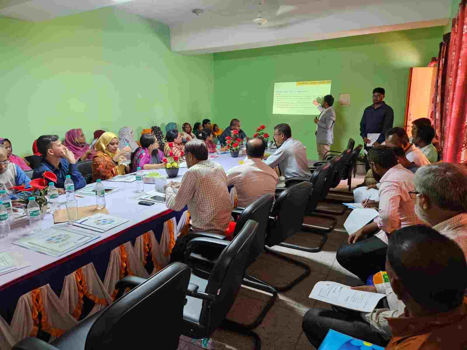
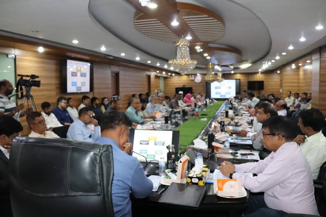
| Consultation Meeting on Maheshpur Municipality Master Plan | A consultation meeting was held at Maheshpur Municipality under the Improving Urban Governance and Infrastructure Program (IUGIP) to guide the preparation of the upcoming Municipal Master Plan. The session was presided over by Md. Sohel Rana, Executive Engineer, while Khadiza Akter, Upazila Nirbahi Officer (UNO) & Administrator, attended as the Chief Guest. Special Guests included Ishtiak Ahmed, Assistant Commissioner (Land), Rafiqul Islam, Upazila Primary Education Officer, officials from Maheshpur Municipality, and representatives from various government bodies, media, business community, and civil society. Md. Rejaur Rahman, FBIP Rahman, Urban Planner, facilitated the meeting and presented survey findings along with the preliminary planning framework. Key issues discussed included waterlogging, road and infrastructure development, waste management, market improvement, education and health facilities, and sustainable urban services. UNO Khadiza Akter highlighted the importance of community participation in ensuring planned, citizen-friendly, and environmentally sustainable urban development for Maheshpur. The initiative is jointly supported by LGED, Maheshpur Municipality, and consulting firms Data Experts Ltd., DevConsultants Ltd., and GPAD Ltd. Date: 13 November 2025 |
 |
|||