Projects
| Name | Projectyear | Projectstatus | Projectsector | Description | Funded By | Client | Client Type | Image | Action |
|---|---|---|---|---|---|---|---|---|---|
| Consultancy Services for Detailed Survey and Feasibility Study of Transmission and Distribution Network within Geographical Area Under Munshigonj PBS and Preparation of BOQ and Cost Estimate to Establish an Underground Distribution Network Replacing | 2021 | Completed | ["Feasibility Study and Design","Power & Energy Sector"] |
Preparation of GIS Based Map Including Physical Features, Geographical Featur ver, Khal, Bridge and Culvert, Water bodies, all Structure etc. UAV image capturing, Imagery digitization and ground truthing. Prepare GIS database and analysis GIS data Detail Base Maps of Existing Physical Features of the Project Area. Detail GIS Maps and database of Existing and Proposed Electrical Distribution Network. Detail GIS Maps of Proposed Underground Design.</p> |
Bangladesh Rural Electrification Board (BREB) | Power Research and Development Consultants Pvt. Ltd., India |  |
||
| Residential Area Development Plan of Ansar Officers Housing Society (AOHS). | 2020 | Completed | ["Urban Planning and Design"] |
Detailed narrative description of project: The proposed project area is locat tives of the project are planning for a residential area and to support the project for implementing the plan through development and supply of land in the private land market. To achieve the main objective, the consultants have to provide services to the followings: • Collection and digitization of RS Mouza maps • Conduct Physical features and Topographic survey; • Prepare Base-map considering the existing Topographic condition for the Planning/Design base; • Preparation of Plan and report with implementation guideline.</p> |
Bangladesh ANSAR-VDP | Bangladesh ANSAR-VDP |  |
||
| Designing Residential Area Master Plan for the Development of Nobodhara Satellite City | 2021 | Completed | ["Urban Planning and Design"] |
Detailed narrative description of project: The main objectives of the project esidential area master plan and to support the project for implementing the plan through development and supply of land in the private land market. To achieve the main objective, the following services to the followings: • Digital Survey • Cadastral Map database preparation • Map processing, Mouza Superimpose and Database Preparation • All required documents preparation for NHA and DoE NOC • NHA layout submission with database for approval</p> |
Nabodhara Real Estate Ltd. | Nabodhara Real Estate Ltd. |  |
||
| GIS Map Preparation of some selected wards of Dhaka City (Ward No. 2,3,5,6,8,14, Dhaka North City Corporation) | 2014 | Completed | ["Urban Planning and Design"] |
Detailed narrative description of project: The main objectives of the project tion of some selected wards of Dhaka City (Ward No. 2,3,5,6,8,14, Dhaka North City Corporation). Specific Objectives of the Assignment are- • To prepare maps to identify location and boundaries of project area; • To prepare physical feature map of project area; • To maintain proper and updated database for any map preparation and database development; • To monitoring and evaluation of project status and key indicators identification.</p> |
Dhaka Ahsania Mission, Dhaka | Dhaka Ahsania Mission, Dhaka |  |
||
| Topographic Survey, GPS Survey, GIS Mapping under Engineering Consultancy Services for Natural Gas Efficiency Project [Installation of Gas Compressor at TITAS (Location-C) and Narsingdi Gas Fields | 2016 | Completed | ["Urban Planning and Design"] |
Detailed narrative description of project: The main objectives of the project phic survey of that area and survey the existing physical features and Collection and digitizing of cadastral information (mouza maps) and matching this to the topographic survey. To achieve the main objective, the consultants have to provide services to the followings: • Collection and digitization of RS mouza maps; • Conduct physical features and topographic survey; • Conduct utility and contour survey; • Prepare base-map considering the existing Topographic condition for the planning/design base.</p> |
SMEC (Bangladesh) Ltd. Dhaka | SMEC (Bangladesh) Ltd. Dhaka |  |
||
| Purchase of Digital UAV Images, Data Processing through Geographic Information System | 2021 | Completed | ["Engineering \/ Digital Survey"] |
Detailed narrative description of project: The main objective of this project mage of 1200 sq km area. Aerial video capturing along the proposed alignments. Submit drone images.</p> |
NESCO | NRECA International |  |
||
| South Asia Tourism Infrastructure Development Project (SATIDP)(Mahasthangarh) | 2015 | Completed | ["Geographic Information System (GIS)"] |
The main objectives of the project were details mapping of the project area i cio economic features identify and land ownership database. Details are followings: • To prepare maps to identify location and boundaries of project area, • To prepare physical feature map of project area, • To maintain proper and updated database for any map preparation and database development, • To monitoring and evaluation of project status and key indicators identification, • To prepare Archaeological monuments, archaeological mounds and other heritage features Surface roads, Railways network mapping, Waterways mapping and Surface water bodies mapping. • Land ownership databased based on mouza and khatian.</p> |
Hexagon Engineering and Planning | Hexagon Engineering and Planning |  |
||
| South Asia Tourism Infrastructure Development Project (SATIDP) (Bagerhat) | 2015 | Completed | ["Urban Planning and Design"] |
Detailed narrative description of project: The main objectives of the project g of the project area including landuse, socio economic features identify and land ownership database. Details are followings: • To prepare maps to identify location and boundaries of project area, • To prepare physical feature map of project area, • To maintain proper and updated database for any map preparation and database development, • To monitoring and evaluation of project status and key indicators identification, • To prepare Archaeological monuments, archaeological mounds and other heritage features Surface roads, Railways network mapping, Waterways mapping and Surface water bodies mapping. • Land ownership databased based on mouza and khatian</p> |
Hexagon Engineering and Planning | Hexagon Engineering and Planning |  |
||
| Land Route Survey Works for Construction of Gas Transmission Pipeline from Meghna ghat to Haripur of Narayanganj District | 2019 | Completed | ["Engineering \/ Digital Survey"] |
Detailed narrative description of project: The ultimate goal of the Route sur ide information and evidence base for Construction of Gas Transmission pipeline from Meghna ghat to Haripur of Narayanganj District. This will be done through preparation of hand drawing or GIS mapping and reconnaissance survey (existing Google map, image capture, GIS map); identification of residential areas, Buildings, Slums, River, Fields, Agricultural lands, Industries. To identify residential areas, Buildings, Slums, River, Fields, Agricultural lands, Industries for Construction of Gas Transmission pipeline from Meghna ghat to Haripur of Narayanganj District. The following scope of services would be taken into account while offering the consultancy service to GTCL (Gas Transmission Company Limited). • To conduct a Route survey the preparation of hand drawing or GIS mapping and reconnaissance survey, such GIS-based mapping exercise would help: to identify and analyses the routes; • To understand the behavior of the Low-Income Consumers, along with their socio-economic condition; estimation of total area; locations of of Meghna ghat to Haripur of Narayanganj District for Construction of Gas Transmission pipeline; • Finally to recommend an action plan and indicative budget for implementing an on-going, easy-to update and user-friendly data collection and management process, which could maintain the city map as accurate and relevant, so that it can act as an effective tool to assist GTCL’s investment and management planning.</p> |
"Gas Transmission Company Limited (GTCL), Dhaka" | "Gas Transmission Company Limited (GTCL), Dhaka" |  |
||
| Topograpgic and Physical Feature Survey for the Pipeline Water Network Route at 05 unions (Bharuakhali, Chaufaldandi, Eidgah, Islamabad, Pokkhali) of Cox's Bazar Sadar Upazilla | 2022 | Completed | ["Engineering \/ Digital Survey"] |
Detailed narrative description of project: The main objective of the project y for the pipeline water Network route in compliance with topographic survey specification and comprising the following: • Existing Road Network (Line) • Physical Feature (Point) • Railway • River/Cannel/ Pond/Ditch • Spot Height/Level • Contour • Scheme area Boundary • Shape Files and AutoCAD files • AutoCAD drawing in A3 Paper</p> |
M/S S.R Enterprise | M/S S.R Enterprise |  |
||
| DND Khal Improvement Project Phase II | 2022 | Ongoing | ["Engineering \/ Digital Survey"] |
The overall objective of the project is to improve DND Khal at phase II. The ect is Narayanganj. The commencement date of the project is May 2022 and the completion date of the project will be in November 2022. Services provided by the consultant are - • Capture Drone image, • Digitization, • Geo-referencing • Demarcation Pillar Survey • Producing Demarcation Map Layout • 3D Mapping • 3D Mapping Updating • Prepare 3D Topography survey Report</p> |
The Government of the People's Republic of Bangladesh | "19 Engineer Construction Brigade, Bangladesh Army" |  |
||
| DND Khal Improvement Project Phase I | 2021 | Completed | ["Engineering \/ Digital Survey"] |
The prime objective of the project is to prepare a watershed catchment area a the water flow of that specific area. The major objectives of the project are elevation/ RL survey database, catchment area and flow analysis map, khal area demarcation map. The survey area is 10sqkm located at the southern part DND khal project area. Project area part 01 is located at Kadamtoli, Narayanganj and part 02 is located at Fatulla, Narayanganj. As per requirement of the project, the consultant will undertake the following major activities: • Khal Demarcation • Road and drain demarcation • Elevation data collection • Catchment area identification.</p> |
The Government of the People's Republic of Bangladesh | Bangladesh Water Development Board |  |
||
| Implementation of GlSbased Management System in Northern Electricity Supply Company Ltd (NESCO) area under the Technical Assistance (TA) component of BPSDCB Project to be financed by the Asian Development Bank (ADB) under Bangladesh Power System Enhanceme | 2021 | Completed | ["Engineering \/ Digital Survey"] |
UAV/Drone Image Capture, Processing and Orthopho Development for GIS use. Geo K Points Database Development of the Project Area</p> |
Nesco | NRECA |  |
||
| ARMY Road Survey for Flash Flood Risk and Vulnerability Assessment | 2018 | Ongoing | ["Engineering \/ Digital Survey"] |
The main objectives of the project are details topographic survey of that are sting physical features and collection and digitizing of cadastral information (mouza maps) and matching this to the topographic survey. To achieve the main objective, the consultants have to provide services to the followings: • Collection and digitization of RS mouza maps; • Conduct physical features and topographic survey; • Prepare base-map considering the existing topographic condition for the planning/design base.</p> |
"Asian Disaster Preparedness Center" | "Asian Disaster Preparedness Center" |  |
||
| Topographic Survey Work of Bangladesh Dhaka Purbachal New Town Water Distribution & Supply Facilities Development PPP Project | 2020 | Completed | ["Engineering \/ Digital Survey"] |
The Purbachal New Town Water Supply Project consists of three parts: the wate istribution pipelines, the deep tube well and the supporting facilities. The total length of water transmission and distribution pipelines is about 640km(distributed on both sides of the 320km road network), the diameter of pipelines range from DN1200 to DN25. The number of deep tube wells is 15. The supporting facilities include an administrative building and a mechanical room.</p> |
United Delcot Water Ltd | United Delcot Water Ltd |  |
||
| Land Survey more or less 160 acres for KDA New Residential Area | 2020 | Completed | ["Engineering \/ Digital Survey"] |
The main objective of the project is to conduct Land Survey more or less 160 sidential Area. Detail survey of the existing physical features and Collection and digitizing of cadastral information (mouza maps) and matching this to the topographic survey. To achieve the main objective, the consultants have to provide services to the followings: • Collection and digitization of RS Mouza maps; • Conduct Physical features and Topographic survey; • Prepare Base-map considering the existing Topographic condition for the Planning/Design base; • Preparation DoE required maps; • Preparation of Plan and report with implementation guideline.</p> |
The Government of the People's Republic of Bangladesh | Khulna Development Authority (KDA) |  |
||
| Digital Topographical Land Survey, Preparation Contour & DEM Map | 2021 | Completed | ["Engineering \/ Digital Survey"] |
• Conduct physical features and topographic survey. • Collection and digi maps • Field data collection and attribute update • Prepare Base-map considering the existing topographic condition for the planning/design base. • Preparation of plan and report with implementation guidelines</p> |
IMC Worldwide | IMC Worldwide |  |
||
| Topographic Survey and Digital Land Survey Work at Purbachal Marine City Project | 2019 | Completed | ["Engineering \/ Digital Survey"] |
The proposed project area New Dhaka Alliance Ltd is located in Purbachal, Dha ves of the project are planning for a residential area and to support the project for implementing the plan through development and supply of land in the private land market. To achieve the main objective, the consultants have to provide services to the followings: • Collection and digitization of RS Mouza maps; • Conduct physical features and topographic survey; • Prepare Base-map considering the existing topographic condition for the planning/design base; • Planning the residential area that includes: Master Plan, Layout Plan, Land use Plan; • Preparation of block-wise detailed layout plan; • Preparation DoE required maps; • Preparation of plan and report with implementation guideline.</p> |
Purbachal Marine City | Atlantic Properties Development Ltd |  |
||
| Topographic survey, hydrographic survey and preparation of land acquisition plan under consulting services for engineering design and procurement support for Dhaka mass rapid transit development project (Line 5, southern route) | 2021 | Completed | ["Engineering \/ Digital Survey"] |
The main objective of the project is detail topographic survey, spot levels w s fixing & surveying for providing approach roads, terminal station, traffic integration area, yards and depot etc. at isolated location in the vicinity of above corridor and cross section survey at 25m interval along the alignment with Total Station and computer AutoCAD and CIVIL 3D drawing. As per requirement of the project, the consultant will undertake the following major activities: • Review the existing Land Acquisition Plan • Updating of the existing Land Acquisition Plan • Prepare Land Acquisition Plan map • Data processing and mapping • Submission of interim and final reports of the works</p> |
The Government of the People's Republic of Bangladesh | STBL |  |
||
| Revise Existing Contingency Plan and Develop Response SOP for Bangladesh Red Crescent Society (BDRCS) | 2021 | Completed | ["Urban Planning and Design"] |
The main purpose of the assignment is to review the existing contingency plan lone) and response manual of BDRCS and in consultation with relevant stakeholders, develop an effective contingency plan and response SOP (standard operating procedure) for BDRCS to ensure that BDRCS can reach most vulnerable people timely and efficiently. Specific Objectives of the Assignment are- • To review the existing contingency plan and other secondary documents; • To develop an effective contingency plan and response SOP for BDRCS.</p> |
IFRC | IFRC |  |
||
| Consultancy Services for De-tailed Survey and Feasibility Study of Transmission and Distribution Network within Geographical Area Under Manikgonj PBS and Prepara-tion of BOQ and Cost Estimate to Establish an Underground Distribution Network Replacing the | 2021 | Completed | ["Feasibility Study and Design","Power & Energy Sector"] |
The main objectives of the project are Inventory and Preparation of Geo-graph ishment of Geo-coordinate including roads, buildings, various installations, empty spaces, sewerage lines, water sup-ply lines, gas transmission lines, telephone and internet lines etc. To achieve the main objective, the consultants have to provide services to the followings: Preparation of GIS Based Map using Drone Image Including Geograph-ical Feature, Existing Road, River, Khal, Bridge and Culvert, Water bod-ies, all Structure etc. Ground trothing of GIS Base Map, Prepare GIS da-tabase and analysis GIS data. Detail Base Maps of Existing Physical Fea-tures of the Project Area. Detail GIS Maps and database of Existing and Proposed Electrical Distribution Network using ArcInfo and Arc GIS 10.5. Detail GIS Maps of Proposed Underground Design.</p> |
Bangladesh Rural Electrification Board (BREB) | Power Research and Development Consultants Pvt. Ltd., India |  |
||
| Consultancy Services for De-tailed Survey and Feasibility Study of Transmission and Distribution Network within Geographical Area Under Narshingdi PBS-2 and Prepa-ration of BOQ and Cost Esti-mate to Establish an Under-ground Distribution Network Replacing | 2021 | Completed | ["Feasibility Study and Design","Power & Energy Sector"] |
The main objectives of the project are Inventory and Preparation of Geo-graph ishment of Geo-coordinate including roads, buildings, various installations, empty spaces, sewerage lines, water sup-ply lines, gas transmission lines, telephone and internet lines etc. To achieve the main objective, the consultants have to provide services to the followings: Preparation of GIS Based Map using Drone Image Including Geograph-ical Feature, Existing Road, River, Khal, Bridge and Culvert, Water bod-ies, all Structure etc. Ground trothing of GIS Base Map, Prepare GIS da-tabase and analysis GIS data. Detail Base Maps of Existing Physical Fea-tures of the Project Area. Detail GIS Maps and database of Existing and Proposed Electrical Distribution Network using ArcInfo and Arc GIS 10.5. Detail GIS Maps of Proposed Underground Design.</p> |
Bangladesh Rural Electrification Board (BREB) | Power Research and Development Consultants Pvt. Ltd., India |  |
||
| Consultancy Services for De-tailed Survey and Feasibility Study of Transmission and Distribution Network within Geographical Area Under Na-rayangonj PBS-1 and Prepara-tion of BOQ and Cost Estimate to Establish an Underground Distribution Network Replacing | 2021 | Completed | ["Feasibility Study and Design","Power & Energy Sector"] |
The main objectives of the project are Inventory and Preparation of Geo-graph ishment of Geo-coordinate including roads, buildings, various installations, empty spaces, sewerage lines, water sup-ply lines, gas transmission lines, telephone and internet lines etc. To achieve the main objective, the consultants have to provide services to the followings: Preparation of GIS Based Map using Drone Image Including Geograph-ical Feature, Existing Road, River, Khal, Bridge and Culvert, Water bod-ies, all Structure etc. Ground trothing of GIS Base Map, Prepare GIS da-tabase and analysis GIS data. Detail Base Maps of Existing Physical Fea-tures of the Project Area. Detail GIS Maps and database of Existing and Proposed Electrical Distribution Network using ArcInfo and Arc GIS 10.5. Detail GIS Maps of Proposed Underground Design</p> |
Bangladesh Rural Electrification Board (BREB) | Power Research and Development Consultants Pvt. Ltd., India |  |
||
| Midline study on Strengthening Community Preparedness, Rapid Response and Recovery in Bangladesh | 2022 | Completed | ["Climate Change and Disaster Management, Environment"] |
The overall objective of the study is to adhere the already developed baselin regular data collection against agreed indicators for tracking the implementation and progress, monitoring and evaluation of the project activities till date, and to provide insights to the planned interventions to revisit as per the learning. Through this study, GPAD will develop study methods and frameworks, prepare and submit inception report, prepare draft questionnaires and develop digital questionnaires in KOBO. We will conduct field survey, data collection, conduct FGD, KII, IDI and other relevant assignments and provide trainings to field enumerators as well.</p> |
Margaret A. Cargill Philanthropies | WAVE Foundation |  |
||
| IMPACT MAPPING ANALYSIS THROUGH GIS SURVEY OF WATER POINTS, COMMUNITY CLINIC, EPI SITE, SANITATION POINT, CYCLONE SHELTER, DRR COVERAGE, SOCIAL INCLUSION AND LIVELIHOOD SERVICES. | 2022 | Completed | ["Research Development & Training"] |
GPAD signing a new project titled “Impact Mapping Analysis Through GIS Surv Community Clinic, EPI Site, Sanitation Point, Cyclone Shelter, DRR Coverage, Social Inclusion and Livelihood Services” under Nobo Jatra Project, An USAID Bureau of Humanitarian Assistance (BHA) funded Project led by World Vision Bangladesh with close partnership with the Ministry of Disaster Management and Relief, Government of Bangladesh (GoB) and Winrock International. GPAD will work for preparing impact mapping and analysis through GIS by survey of different points of services and facilities of NJP projects like water points, sanitation points, community clinic, cyclone shelter, nutrition achievement through Severe and moderate malnutrition status, social inclusion coverage, service mapping through DRR intervention, market linkage and access, livelihood mapping etc. and this mapping will represents the impact of NJP intervention of the working area on the basis of baseline data.</p> |
USAID | World Vision Bangladesh | foreign |  |
|
| Conducting needs assessment and GIS mapping in the Low-Income Communities (LICs) for WASH improvement in Ward No 38 & 41 of Chattogram City Corporation (CCC) | 2022 | Completed | ["Water Resources Management"] |
Through this study we conduct an assessment to identify the current situation ures, WASH services and WASH behavior in the low-income communities of the targeted 2 wards under Chattogram City Corporation; Analyse the scope of WASH intervention in the targeted low-income communities to improve the existing WASH facilities, ensure better provision of WASH services and improve the WASH behavior of the dwellers; Prepare a GIS Map based on the analysis, expressing the level of WASH vulnerability in the targeted low-income communities, the scope of investment based on the communities’ ability and willingness, level of hygiene education needs to improve the community’s KAP. GPAD will work on preparing GIS Mapping & WASH profiles in the 02 selected ward of Chattogram City Corporation.</p> |
Water & Sanitation for the Urban Poor (WSUP) | Water & Sanitation for the Urban Poor (WSUP) |  |
||
| Feasibility Study for Establishment of the Kuakata Convention Center | 2022 | Completed | ["Feasibility Study and Design","Power & Energy Sector"] |
We have done the following studies for the convention center. 1. Market/Deman cal/Technological & Engineering analysis 3. Environmental Sustainability Analysis and EIA 4. Climate Resilience and Disaster Risk Analysis (DIA) 5. Cost-Benefit Analysis 6. Human Resources and Administrative Support Analysis Institutional and Legal Analysis 7. Risk (Uncertainty) and Sensitivity Analysis</p> |
District Commissioner Office, Patuakhali | District Commissioner Office, Patuakhali |  |
||
| Consultancy service for Preparation of Master Plan & Feasibility Study of Solar Power Plant Project at Subarnachar, Noakhali, Bangladesh | 2022 | Completed | ["Feasibility Study and Design","Power & Energy Sector"] |
|
O&M Solutions Bangladesh Ltd. | O&M Solutions Bangladesh Ltd. |  |
||
| RPAS (Drone) Survey of the Raw Water Pipeline Route Under Saidabad WTP Phase-III, Component-1 | 2022 | Completed | ["Engineering \/ Digital Survey"] |
The scope of works for this package is the RPAS survey of the raw water pipel the work of RPAS (drone) survey undertaken to capture orthophotographs along the pipeline route.</p> |
Dhaka Water Supply and Sewerage Authority | Dhaka Water Supply and Sewerage Authority |  |
||
| Matarbari Port Development Project (RHD Part). | 2021 | Ongoing | ["Resettlement and Land Acquisition"] |
Preparation of Land Acquisition Plan for Matarbari Port Development Project ( work to prepare land acquisition plan and plot schedule for the project. Road Length Approximately 28 km.</p> |
Japan International Cooperation Agency (JICA) | Roads and Highway | foreign |  |
|
| Preparation of Earthquake Sensitive Land Use Plan (ESLUP) for Sunamganj Municipality | 2021 | Completed | ["Urban Planning and Design"] |
Tasks (but not limited to) that shall have to be carried out by the consultan ill be conducted ward no 2,4,5) if the consultancy is awarded are: i. To prepare and submit the hard and soft copies of the Inception report (research design, methodology, data collection tools, validation mechanism and time-bound work plan); ii. To make a presentation on data collection tools and receive feedback from relevant officials’ others before finalization. iii. To conduct a baseline survey, Key Informant Interview (KII) and Focus Group Discussion (FGD) sessions. iv. Review relevant plans, policies and institutional arrangements. v. To identify earthquake as well as other hazard prone locations and conduct risk assessment for the municipality. vi. To prepare and submit Draft Situation Analysis Report containing base map (detail land use, major features etc.) of the municipality; vii. To formulate the vision, goal and objectives of land use planning, and formulate the strategies to be adopted, the consultant will prepare Land use Plan and building construction guidelines based on hazard risk for the Municipality. viii. To formulate the planning policy documentation and institutional arrangement for implementation of the proposed plan. ix. To prepare and submitted Landuse Plan will indicate policy guidelines for use of lands in the municipality considering earthquake risk relevant to types of soil/land, detail maps with indication of potential uses, recommendations compatible for earthquake risk sensitive development.</p> |
DFID Bangladesh, SIDA, UN WOMEN, UNOPS, UNDP | Sunamganj Municipality |  |
||
| Consultancy Services for aerial imagery capture and 3D surface model development | 2021 | Completed | ["Geographic Information System (GIS)"] |
Consultancy Services for aerial imagery capture and 3D surface model developm Town area under Installation of Water Supply, Sewerage, Drainage System & Solid Waste Management System Rajdhani Unnayan Kartripakkha (RAJUK) is implementing Purbachal New Town project with a goal to develop a modern, well planned township near Dhaka city. The project is located at Rupganj Upazilla of Narayanganj District and Kaliganj Upazilla of Gazipur District. Total area of Purbachal Project is 6,150 acres. A total number of 25,016 residential plots along with commercial, administrative, educational and social infrastructure are going to be constructed under this project. Development and installation of water supply, sewerage, drainage system & solid waste management system is a critical component of the Purbachal New Town project. Traditionally, water & sewerage projects have been developed by formal and traditional public procurement basis. However, in order to access private sector expertise for efficient water and sanitation services and unlock private financing, RAJUK has taken a decision to implement this project on PPP basis. The PPP modality would also enable RAJUK to enter into a partnership with a private sector partner who would be involved in Installation of water supply, sewerage, drainage system & solid waste management system at affordable rates to the residents of the township.</p> |
Rajdhani Unnayan Kartripakkha (RAJUK), Ministry of Housing & Public Works (MoHPW) | United Delcot Bangladesh |  |
||
| Research on a innovative technology in Sanitation Sector | 2021 | Completed | ["Research Development & Training"] |
GPAD will work with BoP Innovation Services Bangladesh Pvt. Ltd. to conduct a amp; Focus Group Discussion at two cities as pilot studies.</p> |
BoP Innovation Services Bangladesh Pvt. Ltd. | BoP Innovation Services Bangladesh Pvt. Ltd. |  |
||
| Existing Khal Demarcation of DNCC | 2021 | Completed | ["Resettlement and Land Acquisition"] |
Following activities will be done: - GIS Shapefile of Feature (Road, Structur Map (CS) - AutoCAD layer file of Land Demarcation Plan with CS Mouza - Topo Map of the Survey Area - UAV Image of the Survey Area - Hard Copy of Land Demarcation Plan</p> |
Dhaka North City Corporation | Dhaka North City Corporation | 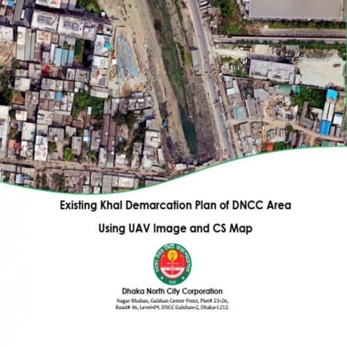 |
||
| Developing Training Manual for the Ward Disaster Management Committee (WDMC) of Dhaka South City Corporation | 2021 | Completed | ["Climate Change and Disaster Management, Environment"] |
Developing Training Manual for the Ward Disaster Management Committee (WDMC) Corporation</p> |
German Red Cross | German Red Cross |  |
||
| WASH Assessment of Chattogram City Corporation (A study in ward no 39 and 40) | 2020 | Completed | ["Database, ICT & System Management"] |
Project Demo - http://wsup.gpadbd.net/ |
WSUP | WSUP |  |
||
| Consultancy Services for Designing Residential Area Plan for Glorious Properties Ltd. | 2014 | Completed | ["Urban Planning and Design"] |
- Digital Land Survey - Detailed Layout and Town Designing of the River Park |
Glorious Properties Ltd. Dhaka | Glorious Properties Ltd. Dhaka |  |
||
| Consultancy Services for Designing Residential Area Plan for New Dhaka Alliance Ltd | 2014 | Completed | ["Urban Planning and Design"] |
- Digital Land Survey - Detailed Layout and Town Designing of the New Dhaka C |
Dhaka Alliance Ltd, Dhaka | Dhaka Alliance Ltd, Dhaka |  |
||
| Detail Design of Three Municipal Building of Kurigram Municipality | 2014 | Completed | ["Urban Planning and Design"] |
- Structural, Engineering & Architectural Design - Cost Estimate - Water il Investigation</p> |
Kurigram Municipality, Bangladesh | Kurigram Municipality, Bangladesh |  |
||
| Consultancy Services for Designing Residential Area Plan for Premium Group | 2018 | Completed | ["Urban Planning and Design"] |
- Prepare Base-map considering the existing Topographic condition for the Pla - Planning the Residential area that includes: Master Plan - Layout Plan, Land use Plan of the areas - Superimposed Map on DAP of RAJUK - Superimposed Map along with Satellite image - Location Mapping - Utility Mapping (Gas, water supply, electricity, drainage system, sewerage system, solid waste management) - Road network plan - Traffic circulation plan - Land subdivision mapping (Sectoral/ Block/ Zonal/ Neighbourhood plan) - GIS Database Development of the Masterplan - Detail layout & maps for DTCA (the entire areas) - Detail layout, maps for DoE (the entire areas)</p> |
Premium Group Ltd., Dhaka | Premium Group Ltd., Dhaka |  |
||
| Residential Area Development Plan of River Park Model Town | 2018 | Completed | ["Urban Planning and Design"] |
Survey Consultancy Services for Temporary Bench Mark Establishment and Layout s, and plot demarcation under River Park Model Town - RTK (Static) Survey - Plot layout of the residential area</p> |
Glorious Properties Ltd., Dhaka | Glorious Properties Ltd., Dhaka |  |
||
| GIS training for Médecins Sans Frontières (MSF) Officials | 2011 | Completed | ["Urban Planning and Design"] |
- GIS Training (Open Source GIS) |
Médecins Sans Frontières (MSF), Bangladesh | Médecins Sans Frontières (MSF), Bangladesh |  |
||
| Consultancy services for Website Development and Management of Nilphamari Municipality | 2012 | Completed | ["Urban Planning and Design"] |
- Website Development and Management (2012) |
Nilphamari Municipality, Bangladesh | Nilphamari Municipality, Bangladesh |  |
||
| Consultancy services for Website Development and Management of Patgram Municipality | 2014 | Completed | ["Urban Planning and Design"] |
- Website Development and Management (2012-2014) |
Patgram Municipality, Bangladesh | Patgram Municipality, Bangladesh |  |
||
| Consultancy services for Gis Training, Website Development and Management of Mymensingh Municipality | 2014 | Completed | ["Urban Planning and Design"] |
- GIS Mapping and GPS Survey (2012) - Website Development and Management (201 |
Mymensingh Municipality, Bangladesh | Mymensingh Municipality, Bangladesh |  |
||
| Consultancy services for GIS Training of East West Property (Pvt.) Ltd, Basundhara Group officials | 2013 | Completed | ["Urban Planning and Design"] |
- GIS Training |
East West Property (Pvt.) Ltd, Basundhara Group, Dhaka | East West Property (Pvt.) Ltd, Basundhara Group, Dhaka |  |
||
| Community Disaster Readiness Assessments for the Enhancing Community preparedness in Bangladesh: Coastal Disaster Risk Reduction Program. | 2023 | Ongoing | ["Climate Change and Disaster Management, Environment"] |
The overall program emphasizes strengthening of community level preparedness of relevant national level systems that will contribute to more effective and sustainable local level preparedness and response actions by the National Society through informed Forecast-Based Actions.</p><p>Specifically, the project aims to ensure:<br>• Individuals and communities build their knowledge of disasters and vulnerabilities; self-organize and take individual and collective actions to establish a culture of preparedness and reinforce their networks and connectedness.<br>• BDRCS has mechanism (local and national) in place to provide accountable, efficient, effective and timely assistance to affected and at-risk populations.</p><p>Work in the eight existing community’s focuses on sustainability of the initiatives imple-mented during Phase I. Activities implemented in the 12 new communities (included in Phase II) in Bagerhat and Patuakhali districts is centered on scaling up of the coastal com-munity-based disaster risk reduction (CBDRR) and school-based disaster risk reduction (SBDRR) program model and expanding it to new communities and schools. For the 5 new communities of Khulna district (included in Phase II), activities are geared towards the rep-lication of the CBDRR and SBDRR model through the newly established CPP organization mechanisms supported by the technical capacities of BDRCS, the International Federation of Red Cross and Red Crescent Societies (IFRC), American Red Cross (AmCross), as well as the Cyclone Preparedness Programme (CPP) and the Ministry of Disaster Management and Relief (MoDMR) of the Government of Bangladesh. The upcoming assessments will be a continuation of prior Community Disaster Readiness Assessment which was done during Oct-Nov 2021 and will utilize the same assessment tools to capture and measure progress and impact over time.</p> |
American Red Cross | IFRC |  |
||
| Consultancy services for Website Development and Management of Municipal Town Planners Association of Bangladesh (MTPAB) | 2013 | Completed | ["Database, ICT & System Management"] |
- Website Development and Maintenance (2013) - www.townplannersbd.org |
Municipal Town Planners Association of Bangladesh (MTPAB), Bangladesh | Municipal Town Planners Association of Bangladesh (MTPAB), Bangladesh |  |
||
| Consultancy services for Website Development and Management of Ulania Social Welfare Society (USWS) | 2014 | Completed | ["Geographic Information System (GIS)"] |
- Website Development and Maintenance (2013-2014) - www.usgsbd.org |
Ulania Social Welfare Society (USWS ), Bangladesh | Ulania Social Welfare Society (USWS ), Bangladesh |  |
||
| Training on Geographic Information System on City Management and Planning | 2014 | Completed | ["Training and Capacity Building"] |
GIS Training of DNCC Staffs |
Dhaka North City Corporation, Dhaka | Dhaka North City Corporation, Dhaka |  |
||
| Disaster Shelter System Phase I (DSSP-I) Project | 2010 | Completed | ["Climate Change and Disaster Management, Environment"] |
- GPS Survey - Database Development - Map Preparation |
Asian Disaster Preparedness Center, Bangladesh | Asian Disaster Preparedness Center, Bangladesh |  |
||
| Data Entry and Analysis and Report Preparation on KAP Baseline Study in Satkhira and Bagerhat Municipality under WASH Alliance Programme | 2013 | Completed | ["Research Development & Training"] |
- KAP Study (Satkhira Municipality) |
Practical Action, Bangladesh | Practical Action, Bangladesh |  |
||
| Data Entry and Analysis and Report Preparation on KAP Baseline Study of ASA | 2013 | Completed | ["Research Development & Training"] |
- KAP Study |
Association for Social Advancement (ASA), Bangladesh | Association for Social Advancement (ASA), Bangladesh |  |
||
| Baseline survey for SAJIDA Foundation's project- Supporting Excluded Population for Water, Sanitation and Hygiene (SEP-WASH) funded by WaterAid in Bangladesh | 2013 | Completed | ["Water Resources Management"] |
- Baseline Survey - Reporting |
Sajida Foundation, Dhaka | Sajida Foundation, Dhaka |  |
||
| Providing Consultancy Services for Digitization mapping data for WSP Piloting Program area, Mirhajirbag, Ward No - 87, Dhaka | 2009 | Completed | ["Geographic Information System (GIS)"] |
- GIS Mapping - Risk Mapping - Baseline Study |
Population Services and Training Center (PSTC), Bangladesh | Population Services and Training Center (PSTC), Bangladesh |  |
||
| Spatial Database Preparation and GIS Mapping | 2011 | Completed | ["Engineering \/ Digital Survey"] |
- GIS Mapping - Database Preparation Assistance - Digital Survey - GIS Traini |
Islamic Relief, Bangladesh | Islamic Relief, Bangladesh |  |
||
| Consultancy services for Physical Feature Survey of Jamalpur Municipality | 2013 | Completed | ["Urban Planning and Design"] |
- Physical Feature Survey |
Jamalpur Municipality, Bangladesh | Jamalpur Municipality, Bangladesh |  |
||
| Consultancy services for GPS Survey and Map Preparation | 2013 | Completed | ["Geographic Information System (GIS)"] |
- GPS Survey - Map Preparation - Database Management |
Resource Planning and Management Consultants (Pvt) Limited (RPMC), Dhaka | Resource Planning and Management Consultants (Pvt) Limited (RPMC), Dhaka |  |
||
| GIS Map Preparation of some selected wards of Dhaka City (Ward No. 2,3,5,6,8,14, Dhaka North City Corporation) | 2014 | Completed | ["Geographic Information System (GIS)"] |
- GIS Mapping - Database Preparation Assistance, Digital Survey |
Dhaka Ahsania Mission, Dhaka | Dhaka Ahsania Mission, Dhaka |  |
||
| GIS Survey and Map Preparation for Site Management Plan under South Asia Tourism Development Plan | 2015 | Completed | ["Geographic Information System (GIS)"] |
- Land use and land cover base data layer - Administrative boundary along wit ks - Archaeological monuments, mounds - Unsurfaced roads and pathways mapping - Railways network, Waterways mapping - Surface water bodies mapping, Habitation areas, Forest Mapping - Socio-Economic Features - Database Preparation</p> |
Department of Archeology, Dhaka | Department of Archeology, Dhaka |  |
||
| GIS Based Model of Union Parishad of Bangladesh | 2016 | Completed | ["Urban Planning and Design"] |
GIS Based Model of Union Parishad of Bangladesh |
Manusher Jonno Foundation, Dhaka | Manusher Jonno Foundation, Dhaka |  |
||
| GIS Map Preparation of some selected wards of Dhaka City (Ward No. 49 and 64, Dhaka South City Corporation) | 2016 | Completed | ["Engineering \/ Digital Survey"] |
- GIS Mapping - Database Preparation Assistance - Digital Survey |
Dhaka Ahsania Mission, Dhaka | Dhaka Ahsania Mission, Dhaka |  |
||
| GIS Database development and analysis for Nationwide Climate Vulnerability Assessment | 2018 | Completed | ["Climate Change and Disaster Management, Environment"] |
- Data collection from different organization - Linked with GIS database - GI an d weightage - Model building for eight sector CVA</p> |
GIZ, Bangladesh | GIZ, Bangladesh |  |
||
| Hazard Map Preparation of some selected wards of Dhaka City (Ward No. 10, 11 and 12, Dhaka North City Corporation) | 2018 | Completed | ["Engineering \/ Digital Survey"] |
- GIS Mapping - Database Preparation Assistance - Digital Survey |
Srwot Bangladesh | Srwot Bangladesh |  |
||
| Consultancy Service for GIS database Preparation of 10 District of MaMoni MNCSP Project funded by USAID. | 2019 | Completed | ["Urban Planning and Design"] |
- Prepare for the spatial maps of project area in a good extent - Monitor and ata base on interactive way - Updated GIS database for any kinds of map preparation & database development for the project area.</p> |
Save the Children, Bangladesh | Save the Children, Bangladesh |  |
||
| Activating Village Courts in Bangladesh Phase II (AVCB II) Project location mapping with ArcGIS funded by EU, GoB and UNDP. | 2019 | Completed | ["Urban Planning and Design"] |
- Map prepared by ArcGIS software in District, Upazila and Union level - Illu t h project infographic information</p> |
UNDP, Bangladesh | UNDP, Bangladesh |  |
||
| Consultancy Services for Baseline Study and GIS Mapping of Wash Assessment Of Primary Schools In The Cities Of Rangpur, Gazipur And Chattogram | 2019 | Completed | ["Water Resources Management"] |
- WASH survey of primary schools in three city corporation - GIS mapping of W |
UNICEF | WSUP, Bangladesh |  |
||
| GIS BASE MAP AND BUILDING DATABASE PREPARATION OF SUNAMGANJ POURASHAVA UNDER NATIONAL RESILIENCE PROGRAMME (NRP) | 2019 | Completed | ["Geographic Information System (GIS)"] |
- Spatial Database in ArcGIS environment (Shapefile without attribute informa da tabase built in ArcGIS environment containing features and attribute</p> |
BUET | BUET |  |
||
| Updating and Validation of GIS Data for Developing Ward Sanitation Action Plan in Ward No. 5 in Jashore Paurashava | 2019 | Completed | ["Water Resources Management"] |
- Creating new GIS database and attributes of wards existing GIS database wit nta inments and road network - Create ward sanitation profile and maps</p> |
SNV Netherlands Development Organization, Bangladesh | SNV Netherlands Development Organization, Bangladesh | foreign |  |
|
| Updating and Validation of GIS Data for Developing Ward Sanitation Action Plans in Three Wards (Ward No. 02, 15 and 22) in Khulna City Corporation | 2019 | Completed | ["Water Resources Management"] |
- Creating new GIS database and attributes of wards existing GIS database wit nta inments and road network - Create ward sanitation profile and maps - Analytical map as supporting tools for Sanitation action Plan</p> |
SNV Netherlands Development Organization, Bangladesh | SNV Netherlands Development Organization, Bangladesh | foreign |  |
|
| GIS-Based Sanitation Mapping for Gazipur City Corporation | 2020 | Completed | ["Geographic Information System (GIS)"] |
- Creating new GIS database and attributes of wards existing GIS database wit nta inments and road network - Create ward sanitation profile and maps</p> |
The World Bank Group, Bangladesh | SNV Gazipur |  |
||
| GPS and Total station Based Advanced Topographic Survey and Preparation of Layout Plans for Eco Tourism Site | 2014 | Completed | ["Engineering \/ Digital Survey"] |
- GIS Mapping - Database Preparation Assistance - Digital Survey |
Relief International, Bangladesh | Relief International, Bangladesh |  |
||
| Topographic Survey and Exposure Map Preparation of Rohinga Camp, Ukhiya, Cox’s Bazar | 2018 | Completed | ["Geographic Information System (GIS)"] |
- Detailed Topographic Survey - Utility Survey - Contour Survey - Landuse Map ap Preparation</p> |
Asian Disaster Preparedness Center (ADPC), Bangladesh | Asian Disaster Preparedness Center (ADPC), Bangladesh |  |
||
| Digital Road Survey Work Chunkutia Road, Mirerbazar Bazar to Kaliganj Bazar & Karaniganj Model Thana to Kaliganj Jora Bridge at Karaniganj, Dhaka | 2018 | Completed | ["Engineering \/ Digital Survey"] |
- Topographic Survey |
Nasrul Hamid Foundation | Nasrul Hamid Foundation |  |
||
| Consultancy Services for GNSS/RTK Survey (Static) and Field Layout Checking and Estern Housing – Swadesh Properties Ltd. | 2018 | Completed | ["Engineering \/ Digital Survey"] |
- RTK (Static) Survey - Permanent Bench Mark Installation - Boundary demarcat den tial Area - Plot layout of the residential area</p> |
Swadesh Properties Ltd. Dhaka | Swadesh Properties Ltd. Dhaka |  |
||
| Consultancy Services for GNSS/RTK Survey (Static) and Boundary Demarcation – Sornali Residential Area, Swadesh Properties Ltd. | 2018 | Completed | ["Engineering \/ Digital Survey"] |
- RTK (Static) Survey - Permanent Bench Mark Installation - Plot layout of th p> |
Swadesh Properties Ltd. Dhaka | Swadesh Properties Ltd. Dhaka |  |
||
| Consultancy services for Traffic Impact Assessment (TIA) preparation of Sunvalley Residential Area of Swadesh properties Ltd. | 2018 | Completed | ["Geographic Information System (GIS)"] |
- Traffic Impact Assessment (TIA) - Traffic Volume Survey |
Swadesh Properties Ltd. Dhaka | Swadesh Properties Ltd. Dhaka |  |
||
| Digital Land Survey of 40 Katha Land adjacent with Hatirjheel Area. | 2018 | Completed | ["Engineering \/ Digital Survey"] |
- Topographic Survey |
Healthcare Pharmaceuticals Ltd | Healthcare Pharmaceuticals Ltd |  |
||
| Baseline study on the situation of water, sanitation and hygiene in Horizon Palli in Tangail | 2011 | Completed | ["Water Resources Management"] |
- GIS Mapping - Baseline Study - Baseline Survey and Reporting, Evaluation More |
Population Services And Training Center (PSTC) | Population Services And Training Center (PSTC) |  |
||
| Baseline Survey and Mapping of Four Selected Wards of Mymensingh Municipality under Solid Waste Management Program of Mymensingh Municipality funded by UNICEF in Bangladesh | 2012 | Completed | ["Geographic Information System (GIS)"] |
- GIS Mapping and GPS Survey (2012) - Website Development and Management (201 |
Mymensingh Municipality | Mymensingh Municipality |  |
||
| Consulting Services for Preparation of the Project proposal (PP) under Municipal Governance and Services Project-BMDF part for Preparation of the First Year Implementation Program of MGSP | 2015 | Completed | ["Governance & Policy Management"] |
- Project proposal outlining, design criteria and detailed designs, and cost d ocuments including technical specifications and bills of quantities; - O&M plans - Data regarding environmental and social safeguard issues.</p> |
Savar Municipality, Savar | Savar Municipality, Savar |  |
||
| Urban WASH Assessment and Slum Mapping for Chattogram City Corporation funded by UNICEF in Bangladesh | 2019 | Completed | ["Water Resources Management"] |
- Prepare maps to identify location and boundaries of important slums in the am City Corporation. - TAB Based Questionnaire Survey - Slum Mapping - WASH Utility Mapping - FGD, KII - Reporting</p> |
Chattogram City Corporation, Chattogram | Chattogram City Corporation, Chattogram |  |
||
| Consulting Firm for Developing IEC Materials and 03 days Tarining Manual on DRR, CCA and Inclusion for Capacity Building of Emergency Response Program Team in Cox’s Bazar | 2019 | Completed | ["Urban Planning and Design"] |
- Develop IEC materials (flipbooks/chart) targeting volunteer and youth/adole and a dults to promote DRM issues and address topics related DRM awareness (Disaster-Concept, risk, preparedness and mitigation). - Develop a 03 days training module on Concept of DRR & CCA & principles, community based disaster preparedness process and method for Rohingya and host community level.</p> |
Plan International | Plan International |  |
||
| CONSULTANCY SERVICES FOR GIS MAPPING OF LICS IN DHAKA SOUTH CITY CORPORATION | 2019 | Completed | ["Water Resources Management"] |
- Prepare maps to identify location and boundaries of important slums in the s) of Dhaka South City Corporation. - Prepare Slum map with Water Supply/ Water Points, Latrines, waste Disposal Points and Water related Structures and features, Linear feature Collection like Drainage Network, Road Network etc. - TAB Based Questionnaire Survey - Slum Mapping - WASH Utility Mapping - FGD, KII - Reporting</p> |
Dhaka South City Corporation, Dhaka and WSUP, Bangladesh | Dhaka South City Corporation, Dhaka and WSUP, Bangladesh |  |
||
| Consultancy Services for WASH Behaviour and Infrastructure Condition in Low Income Communities of Ward No. 39 & 40 of Chattogram City Corporation (CCC) | 2020 | Completed | ["Water Resources Management"] |
- To assess the existing WASH facilities of the clusters and identify the WAS rti cipatory interventions. - To prepare GIS map and database of the identified clusters focusing on WASH findings and other major features.</p> |
WUSAP | Water & Sanitation for the Urban Poor (WSUP), Bangladesh |  |
||
| CONSULTANCY SERVICES FOR ‘’TO DEVELOP MULTI-HAZARD CONTINGENCY PLAN FOR CHATTOGRAM CITY CORPORATION”. | 2019 | Completed | ["Urban Planning and Design"] |
- Conducting FGD and KII in CCC - Development of emergency response plan, eva nsi bilities of stakeholders</p> |
Chattogram City Corporation, Chattogram and Save the Children, Bangladesh | Chattogram City Corporation, Chattogram and Save the Children, Bangladesh |  |
||
| Feasibility study of distribution network at Dhaka City Corporation & adjacent area in Dhaka district under Dhaka Palli Bidyut Samity-1 and preparation of BOQ and cost estimate to establish an under-ground distribution network | 2023 | Ongoing | ["Feasibility Study and Design","Power & Energy Sector"] |
The main objectives of the projectare Inventory ration of Geographical Map with Establishment of Geo-coordinate includingroads, buildings, variousinstallations, empty spaces,sewerage lines, water supply lines, gas transmission lines, telephone and internet lines etc. To achieve the main objective, the consultants have to provide services to the followings:</p><ul><li>Preparation of GIS Based Map using Drone Image Including Geographical Feature,Existing Road, River,Khal, Bridge and Culvert,Water bodies, all Structure etc.</li><li>Ground trothingof GIS Base Map, PrepareGIS database and analysis GIS data</li><li>Detail Base Maps of Existing PhysicalFeatures of the Project Area.</li><li>Detail GIS Maps and database of Existing and Proposed Electrical Distribution Network using ArcInfo and Arc GIS 10.5</li></ul><p>Detail GIS Maps of Proposed Underground Design.</p> |
Dhaka PBS 1 | Bangladesh Rural Electrification Board (BREB) Dhaka |  |
||
| In-Depth Socio Economic study for the Boat Resident Communities of Bangladesh Through Spatial Analysis | 2023 | Ongoing | ["Research Development & Training"] |
The utmost scope of works is as follows but not limited to the following |
Oxfam International | Oxfam International |  |
||
| Bangladesh Railway Asset Management (MIS & GIS Department) | 2021 | Completed | "\"[\\\"Database, ICT & System Management\\\"]\"" |
We developed a custom WEBGIS dashboard for Bangladesh Railway(MIS & GIS d shboard Features :</p><ul><li>Map View</li><li>Zoom In</li><li>Zoom Out</li><li>Search</li><li>Group Search</li><li>Measure</li><li>User Registration</li><li>User Portal</li></ul> |
Bangladesh Railway | Bangladesh Railway |  |
||
| A Custom Website for Khulna University Graduates Club. | 2023 | Completed | "[\"Database, ICT & System Management\"]" |
We are developing a custom Khulna University Graduates Club(KUGCL) website.More : </p><ul><li>Member Database</li><li>Member Search</li><li>Member Profile</li><li>Blog</li><li>Authentication</li><li>Admin Panel</li><li>News</li><li>Publication</li></ul> |
KUGCL | KUGCL |  |
||
| Consultancy Service on Anticipatory Action Research using Baseline and Endline Survey | 2023 | Ongoing | ["Research Development & Training"] |
|
World Vision International | World Vision International | foreign |  |
|
| Enhance BSL2 Laboratory in Somalia | 2023 | Ongoing | ["Architectural Engineering Solution"] |
On behalf of the World Health Organization (WHO) as the lead implementing age valued the invitation to the Biosafety level-2+ (BSL-2+) laboratory is applicable to clinical, diagnostic, teaching and research facilities where there is no access to the BSL-3 laboratory. In this laboratory, work is performed with agents that may cause serious or potentially lethal disease through inhalation to the personnel and may contaminate the environment. In general, BSL-2+ laboratory means the application of BSL-3 practices and procedures in a BSL-2 laboratory to provide additional safety and protective enhancement. The technical approach and methodology of the task to be conducted to accomplish the stated objectives and activities stated in the concept note are presented in the following sections keeping the complexity of the task in mind. We have used our experience experts while preparing this methodology. However, before presenting the technical approach and methodologies, in light of the concept note, our understanding of the project documents is discussed. </p> |
World Health Organization (WHO) | World Health Organization (WHO) |  |
||
| Topographic Survey, Condition Survey and Level Survey at Noakhali Municipality | 2023 | Ongoing | ["Engineering \/ Digital Survey"] |
Will boost facility service demand and lower the risk of mortality. |
Noakhali Municipality | Noakhali Municipality |  |
||
| Field Survey for Consulting Services for Railway Connectivity Improvement Preparatory Facility Project in The People’s Republic of Bangladesh | 2023 | Ongoing | ["Engineering \/ Digital Survey"] |
Project Area: 800 sq. km Detailed narrative description of project: Overall o ve the Railway connectivity across the country by identifying and measuring major railways as well as analyzing crossing lines. The specific objectives are: To identify main rail line, to create topographic map of 800 km railway network, to measure short and long bridge, as built drawing of existing bridge & culvert, to analyses cross section & long section of main rail line and Bethemetic Survey of river under the railway network. Detailed description of actual services provided by the staff: Mobilization and Demobilization, Benchmark Installation (300 mm X 300mm X 1000mm), GCP Survey (GNSS Static Method) 3hrs, Leveling Survey, Topographic Mapping Survey (Including the Existing Bridge), Longitudinal Survey for the River, Cross section survey in the river including Existing Bridge, Longitudinal Survey for the Main Rail Line, Cross Sec-tion Survey for the Main Rail Line, Existing Long Bridge Measurement, Existing Short Bridge and Culvert Measurement, Utility Investigation, Survey Data and Drawing Prepara-tion and printing. Survey Report</p> |
Oriental Consultants Global CO., LTD (OCG) | Oriental Consultants Global CO., LTD (OCG) |  |
||
| Institutional Analysis and Development of Monitoring Framework for Implementation of Action Plan for Sustainable Plastics Management. | 2023 | Ongoing | ["Research Development & Training"] |
Detailed narrative description of project: |
World Bank | World Bank | foreign |  |
|
| Implementation of BCC campaign in Gazipur City Corporation Project | 2023 | Ongoing | ["Research Development & Training"] |
Detailed narrative description of project: The preparation of an urban develo azipur City Corporation Area is included in the scope of the consulting work for this project. This project will cover every aspect of creating an urban development plan, such as project prioritization and phasing, the structure plan, the composite development management plan, the land use plan, the area action plan, the traffic & transportation management plan, the drainage & environmen-tal management plan, the urban services plan, disaster Management plan etc.</p> |
World Bank | World Bank | foreign |  |
|
| Traffic Survey Work in Gabtoli Area | 2023 | Completed | ["Engineering \/ Digital Survey"] |
The main objective of the project is detail traffic survey, spot levels with xing & surveying for providing approach roads, traffic integration areas. As per requirement of the project, the consultant will undertake the following major activities: <br>• Traffic volume survey;<br>• Geometric Feature Survey;<br>• Location Map Preparation;<br>• Collection of primary and secondary data related to existing traffic;<br>• Traffic Impact Analysis. Data processing and mapping<br>• Submission of interim and final reports of the works </p> |
China Harbour Engineering Company Limited | China Harbour Engineering Company Limited |  |
||
| RPAS (Drone) Survey of the Distribution Network Pipeline Component-3, SWTPPP Phase-III | 2023 | Completed | ["Geographic Information System (GIS)"] |
RPAS (Drone) Survey of the Raw Water Pipeline route under Saidabad WTP Phase- re 24.68 km area. RPAS (Drone) Survey of sections of Raw Water Pipeline route stated following activities:<br>• Orthophoto collection<br>• Georeferenced orthomosaic processing <br>• Base feature digitization shapefile preparation<br>• Field data collection and attribute update <br>• RPAS (drone) survey undertaken to capture Orthophotographs along the pipeline route <br>• Topographic Survey undertaken to capture required elevation data along the pipeline route</p> |
Dhaka Water Supply and Sewerage Authority | Dhaka Water Supply and Sewerage Authority |  |
||
| Feasibility Study to establish an Underground Distribution Network by replacing the existing Overhead Distribution Network under Gazipur Palli Bidyut Samity-1 | 2023 | Ongoing | ["Power & Energy Sector"] |
The main objective of the project is to establish an Underground Distribution g the existing Overhead Distribution Network under Gazipur Palli Bidyut Samity-1Inventory and Preparation of Geographical Map with Establishment of Geo-coordinate including roads, buildings, various installations, empty spaces, sewerage lines, water supply lines, gas transmission lines, telephone and internet lines etc. To achieve the main objective, the consultants have to provide services to the followings:<br>• Preparation of GIS Based Map using Drone Image Including Geographical Feature, Existing Road, River, Khal, Bridge and Culvert, Water bodies, all Structure etc.<br>• Ground trothing of GIS Base Map, Prepare GIS database and analysis GIS data<br>• Detail Base Maps of Existing Physical Features of the Project Area.<br>• Detail GIS Maps and database of Existing and Proposed Electrical Distribution Network using ArcInfo and Arc GIS 10.5<br>• Detail GIS Maps of Proposed Underground Design.<br>Detailed description of actual services provided by the staff:<br>• Capturing UAV Image<br>• Drone Survey,<br>• Basemap Preparation, <br>• Electric Inventory Preparation (Pole Survey, Consumer Survey, SLD Preparation) <br>• GIS related works<br>• Physical Features Extraction from UAV Images<br>• RTK Referencing Point<br>• Level Fly<br>• Detailed Topographic Survey<br>• Submission of final report and maps.</p> |
Bangladesh Rural Electrification Board (BREB) Dhaka | Bangladesh Rural Electrification Board (BREB) Dhaka |  |
||
| Formative Research on Social Behaviour Change Commu-nication (SBCC) for “Strengthening the Maternal and Neonatal Health System | 2023 | Ongoing | ["Research Development & Training"] |
The overall goal of the project is to “Strengthened maternal and child heal hy pregnancy and safe childbirth”.<br>The project has the following objectives:<br>1. To increase awareness about maternal and newborn health.<br>2. To increase utilization of ANC, PNC, and facility delivery services.<br>3. To improve health policy of the recipient country’s government 4. To contribute to achievement of govt development cooperation policies and strategic goals<br>5. To increase the competencies of project participants</p> |
Save the Children International | Save the Children International |  |
||
| Pre-assessment of the Effectiveness of Severe Acute Malnutrition (SAM) pilot Initiative in Six Districts of Bangladesh | 2023 | Ongoing | ["Research Development & Training"] |
Children with SAM are frequently neglected until difficulties arise because C ement of<br>Acute Malnutrition (CMAM) lacks an organized community component. In order to provide and complete facilitybased<br>SAM treatment in accordance with national protocol, poor families with SAM children who are qualified to<br>be admitted into healthcare facilities can be targeted for inclusion in the financial support program. This financial<br>aid is intended to encourage low-income families with SAM children under the age of five to admit and complete<br>SAM treatment at the designated facilities in accordance with national protocol. It serves as a "compensation to<br>wage loss, transportation, and other associated costs" during the facility-based SAM treatment.</p> |
Save the Children International | Save the Children International |  |
||
| Preparation of Urban Development Plan for Gazipur City Corporation Area | 2022 | Completed | ["Engineering \/ Digital Survey"] |
The preparation of an urban development plan for the Gazipur City Corporation the scope of the consulting work for this project. This project will cover every aspect of creating an urban development plan, such as project prioritization and phasing, the structure plan, the composite development management plan, the land use plan, the area action plan, the traffic & transportation management plan, the drainage & environmen-tal management plan, the urban services plan, disaster Management plan etc.</p> |
19 Engineer Construction Brigade, Bangladesh Army | Bangladesh Army |  |
||
| Land Acquisition Plan (Lap) And Plot Schedule Preparation For The Madani Avenue To Balu River (Major Road 5) And Balu River To Shitolakkhya (Major Road 5a) Road Project | 2022 | Completed | ["Resettlement and Land Acquisition"] |
The main objectives of the project are details Land Acquisition Plan and Plot n for the Madani avenue to Balu River (Major Road 5) and Balu River to Shitolakkhya (Major Road 5A) road project. As per requirement of preparation of Land Ac-quisition Plan (LAP) and Plot Schedule of the project, the consultant will undertake the following major activities: Scan Mouza Maps with high quality scanner, Geo-referencing of 155 Mouza Sheets, Digitization of those mouza in ArcGIS platform, Preparation of land acquisition plan for the land area to be affected by the project, Prepare plot schedule for LAP, Process data and prepare digital maps of land to be acquired by the project, Prepa-ration of layout plan with appropriate scale if required, Submission of Report.<br> </p> |
24 Engineer Construction Brigade, Bangladesh | 24 Engineer Construction Brigade, Bangladesh |  |
||
| Knowledge Attitude & Practice (KAP) Survey Data Analysis and Reporting for IFRC/BDRCS WASH Sector | 2022 | Completed | ["Water Resources Management"] |
The main objective of the project is to Improving access to water, sanitation development targets as set in the SDGs 2.2, 6.1 and 6.2. Growing evidence has accumulated the positive impact that improved behaviors on sanitation and hygiene have on reducing stunting. As per the requirement of the project, the consultant has to do the following tasks:<br>• Assess previous Knowledge, Attitudes and Practices as per previous database from KAP survey. <br>• Provide recommendations for the implementation of future WASH projects. <br>• Produce a qualitative report based on hygiene behaviors analyzing data of two KAP surveys for host and camp communities (comparing the baseline and end-line KAP). <br>• Develop a detailed workplan <br>• Clean data set <br>• Field visit, FGD, KII<br>• Validity of the collected data<br>• Review the raw KAP data set for analysis<br>• Develop an analytical frame<br>• Analysis the data in a frame<br>• Debriefing about the findings <br>• Prepare and deliver a survey report – (draft, review and finalize).<br>Detailed description of actual services provided by the staff:<br>• Inception report with work plan<br>• Analysis Report<br>• PPT Presentation<br>• Draft Report<br>• Final Report</p><p> </p><p> </p><p> </p> |
IFRC | IFRC |  |
||
| Impact mapping analysis through GIS survey of water points, community clinic, EPI site, Sanitation point, cyclone shelter, DRR coverage, social inclusion and livelihood services | 2022 | Completed | ["Research Development & Training"] |
The main objective of the project is to The main objective of the assessment mapping and analysis through GIS by survey of different points of services and facilities of NJP projects like water points, sanitation points, community clinic, cyclone shelter, nutrition achievement through Severe and moderate malnutrition status, social inclusion coverage, service mapping through DRR intervention, market linkage and access, livelihood mapping etc. and this mapping will represents the impact of NJP intervention of the working area on the basis of baseline data. As per requirement of the project, the consultant will undertake the following major activities: <br>• Mapping water points coverage status from start to end of the project<br>• Mapping beneficiary coverage of the water points from start to present<br>• Mapping safe sanitation coverage from start to end status<br>• Mapping shelter center effectiveness and its coverage status and compare year wise growth status<br>• Mapping children coverage by GMP Session year wise growth status from start to present<br>• Mapping effectiveness and efficient use of Conditional Cash Transfer (CCT) by USG supported pregnant and lactating women.<br>• App based GIS survey and KII<br>• Mapping of SAM and MAM cases, nutritional impact, EPI services, health coverage<br>• Mapping impact of the community to receive service availability and accessibility by community service providers<br>• Social inclusion mapping, market access and livelihood impact mapping<br>• DRR coverage and impact mapping<br>• Preparation and submission of inception report<br>Detailed description of actual services provided by the staff:<br>• Inception Report with Methods<br>• Draft Methodology <br>• Draft Survey report<br>• Final study Report</p><p> </p><p> </p><p> </p> |
World Vision Bangladesh | World Vision Bangladesh | foreign |  |
|
| Monitoring, Review & Evaluation Tasks of Ashrayon-2 Project (4th Phase) | 2022 | Completed | ["Research Development & Training"] |
IMED has been conducting special monitoring, review and evaluation tasks for |
IMED | IMED |  |
||
| Strengthening the resilience of refugees and internally displaced persons and host communities through disaster risk management, livelihood interventions and strengthening of the capacities of the National Societies in Bangladesh and Myanmar | 2022 | Completed | ["Climate Change and Disaster Management, Environment"] |
The main objective of the project is to strengthen the resilience and improve ns of vulnerable groups in host communities and displaced populations through Disaster Risk Management, livelihood interventions and through strengthening of the operational and institutional capacities of the National Societies in Bangladesh and Myanmar. As per requirement of the project, the consultant will undertake the following major activities: <br>• Desk review (project proposal, project different event reports, log frame, baseline report, annual report, evaluation documents etc.)<br>• Prepare inception report and submit to GRC<br>• Finalization and submission of the final inception report to GRC<br>• Development of data collection tools<br>• Field test and finalization of data collection tools<br>• Recruitment of data enumerators and Training for the data enumerators<br>• Data collection at study sites (BGD)<br>• Prepare and submit draft data analysis and the initial findings to GRC project team and incorporate of feedback<br>• Prepare first draft of the MTE report<br>• GRC team to review the first draft of the MTE report and share feedback<br>• Validation of evaluation findings and recommendations<br>• Finalization of the MTE report and submission with the data and analyses .</p><p> </p><p> </p><p> </p> |
CRS Bangladesh | CRS Bangladesh |  |
||
| SOKKHOMOTA II – Collaborate, Prepare and Resilient to Natural and Human Induced Disasters | 2022 | Completed | ["Climate Change and Disaster Management, Environment"] |
Detailed narrative description of project: |
CRS Bangladesh | CRS Bangladesh |  |
||
| Citywide Assessment | 2022 | Completed | ["Climate Change and Disaster Management, Environment"] |
The main objective of the project is to describe and analyzed the current sit ities focusing social, economic, natural, environmental. Institutional aspects of relevant agencies will also be reviewed and described. The assignment is evaluative because it will analyze the stakeholder in the study area. As per the requirement of the project, the consultant will undertake the following major activities: <br>• Desk review (project proposal, project different event reports, log frame, baseline report, annual report, evaluation documents etc.)<br>• Prepare inception report and submit to GRC<br>• Finalization and submission of the final inception report to GRC<br>• Development of data collection tools<br>• Field test and finalization of data collection tools<br>• Recruitment of data enumerators and Training for the data enumerators<br>• Data collection at study sites (BGD)<br>• Prepare and submit draft data analysis and the initial findings to GRC project team and incorporate of feedback<br>• Prepare first draft of the MTE report<br>• GRC team to review the first draft of the MTE report and share feedback<br>• Validation of evaluation findings and recommendations<br>• Finalization of the MTE report and submission with the data and analyses <br> </p><p> </p><p> </p> |
World Vision | World Vision | foreign |  |
|
| Wall Construction for Metronet, Plot No-17, Kalikor IT Park | 2022 | Completed | ["Feasibility Study and Design"] |
Metronet Bangladesh Limited conducted Wall Construction for Metronet, Plot No Project in 2022 at Kalikor Upazila in Gajipur District. In this assignment the activity of GPAD team were Digital land survey, Soil cutting with Veccu Machine, Earth Excavation, Material Purchase, Coloumn Footing Set up, Boundary CC work, Grade beam, Beam Works, Coloumn Works, Brick works and construction supervision.<br>Detailed description of actual </p> |
Metronet Bangladesh Limited | Metronet Bangladesh Limited |  |
||
| Aerial Survey (UAV Survey Data Collection, Digital Image Processing and Orthophoto Preparation using Geographic Information Service- GIS) of Treated Water Pipeline Route (P2) from Gandharbpur Water Treatment Plant to Natun Bazar (via Madani Avenue) | 2022 | Completed | ["Engineering \/ Digital Survey","Geographic Information System (GIS)"] |
Resort at BAF Shamsshernagar stated following activities: Drone/ UAV Survey. tos Capture using Drone. Topographic Survey. Tree Inventory. Da-ta pro-cessing and mapping. Submission of final CAD drawing and reports Detailed description of actual services provided by the staff: AutoCAD and PDF file. Video and Orthophoto. Final Report. Demarcation Survey. RPAS survey equipment itinerary. Calibration certificates. Activity log including progress on ac-tivities. Digital orthophotography image files in tiff format. Raw videos provided in mp4 for-mat.</p> |
China CAMC Engineering Co. Ltd | China CAMC Engineering Co. Ltd |  |
||
| Resort at BAF Shamsshernagar | 2022 | Completed | ["Engineering \/ Digital Survey"] |
Resort at BAF Shamsshernagar stated following activities: |
Development Design and Management | Development Design and Management |  |
||
| Preparation of Earthquake Sensitive Land Use Plan. | 2021 | Completed | ["Urban Planning and Design"] |
The overall objective of the project is to enhance resilience of urban develo unicipality through inclusive, gender responsive disaster management and risk informed development. There are also some specific objectives as like have to identify existing land use and potential hazard prone areas in Sunamganj Municipality with regard to earthquake. Also identify the risk related to land profile and explore the areas interventions and provide guidelines for earthquake friendly construction and earthquake sensitive development. To achieve the main objective, the consultants have to provide services to the followings:<br>• Prepare and submit Inception report;<br>• Conduct detail survey (plot to plot) for the ward 2,4 and 5 of the municipality and an overall survey for major physical feature for whole municipality;<br>• Identify earthquake as well as other hazard prone locations and conduct risk assessment for the municipality.<br>• Submit draft situation analysis report containing base map.<br>• Prepare land use plan and building construction guidelines.<br>• Detail map with potential uses, recommendations compatible for earthquake risk sensitive data preparation<br>• Preparation of plan and report with implementation guideline.<br>Detailed description of actual </p> |
Sunamganj Paurashava | Sunamganj Paurashava |  |
||
| Procurement of GIS Software of Different Installation under Mechanical Department of Bangladesh Railway | 2021 | Completed | ["Geographic Information System (GIS)","Database, ICT & System Management"] |
Development of MIS Software of Different Installations Under Mechanical Depar led description of actual services provided by the staff:<br>• Web MIS Based Website Development.<br>• Hardware Supply and Installation.</p> |
Bangladesh Railway | Bangladesh Railway |  |
||
| Land Acquisition Plan (Lap) And Plot Schedule Preparation and Digital Database Preparation for Matarbari Port Development Project (RHD Component)- MPDP using GIS Length of the Approximately Alignment 28 km | 2021 | Ongoing | ["Resettlement and Land Acquisition"] |
The main objectives of the project are details Land Acquisition Plan (Lap) An aration and Digital Database Preparation for Matarbari Port Development Project (RHD Component)- MPDP using GIS Length of the Approximately Alignment 28 km. The scope of the “review and updating of the existing Land Acquisition Plan” works consists of the following tasks:<br>• Scan Mouza Maps with high quality scanner. <br>• Geo-referencing of 27 Mouza Sheets<br>• Digitization of those mouza in ArcGIS platform;<br>• Preparation of land acquisition plan for the land area to be affected by the project;<br>• Prepare plot schedule for LAP;<br>• Process data and prepare digital maps of land to be acquired by the project;<br>• Preparation of layout plan with appropriate scale if required;<br>• Submission of Report.<br>Detailed description of actual services provided by the staff:<br>• Reconnaissance survey, project design;<br>• Collection of mouza maps, statistical data and information;<br>• Mouza Scanning, Georeferencing<br>• Mouza digitization, spatial adjustment and database preparation<br>• Land Acquisition Survey;<br>• Alignment Survey;<br>• Land Acquisition Plan Preparation;<br>• Plot Schedule Preparation;<br>• Preparation and submission of draft final report; and<br>• Submission of final report and maps.</p> |
Christian Commission for the Development of Bangladesh (CCDB), Dhaka | Christian Commission for the Development of Bangladesh (CCDB), Dhaka |  |
||
| Training on Geographic Information System (GIS) for Development Professionals | 2021 | Ongoing | ["Training and Capacity Building"] |
The main objective of the assignment is to provide professional training to t fficials, which includes MS Office Professional, MS Word, Web Design, Database Development, Graphics Design, Data Entry etc. The duration of the training was 1 month long. <br> </p> |
Ipas Bangladesh | Ipas Bangladesh |  |
||
| Market and Technology Research on Biofil Toilet | 2021 | Completed | ["Research Development & Training"] |
The proposed project area is in Gazipur, Manikganj. The main objectives of th erstand peoples’ perception towards Biofil technology, to conduct B2C investigation in identified Urban and Peri urban areas, to conduct household survey, Focus Group Discussion (FGD) and Deep Interview. To achieve the main objective, the consultants have to provide services to the followings:<br>• Household survey and <br>• Arrangement of FGD (Focus Group Discussion)<br> </p> |
BoP Innovation Services Bangladesh Pvt. Ltd | BoP Innovation Services Bangladesh Pvt. Ltd |  |
||
| Assessment of digital readiness of selected Paurashava and city corporation in Bangladesh for adopting support CRISC project | 2021 | Completed | ["Climate Change and Disaster Management, Environment"] |
The main objective of the project is to assess digital readiness of selected corporation in Bangladesh for adopting support CRISC. This assignment will assist the project to have a clearer understanding about the actual scenario in the selected cities to know (i) how much the stakeholders are familiar with the application of digital devices and software’s, (ii) how efficiently they are using and, (iii)which particular IT area (i.e. use of software, basic IT orientation, etc.) the staffs require support to enhance their knowledge and skills, (iv) willingness and readiness to participate in online capacity development measures (i.e. trainings, workshops, online discussions and exchange of experiences/learning, online seminars, etc.), (v) requirement of IT equipment and facilities (i.e. computers, software’s, internet connectivity, etc.). As per the requirement of the project, the consultant has to do the following tasks:<br>• Supervise and coordinate the whole team and undertake necessary visits to the city offices and respective project partners’ offices in Dhaka where the relevant departments and organizations are located (MAB, NILG, LGED and UDD) to conduct the survey and KII.<br>• Responsible to conduct KII with responsible officials of 5 selected cities (Sirajganj, Satkhira, Rajshahi, Barishal and Khulna) and MAB, NILG, UDD, and LGED on IT- infrastructure and server capacities focusing on coding/designing of webpages and further digital formats (e.g., digital platforms).<br>• Overall responsibility for the advisory packages of the contractor (quality and deadlines)<br>• Coordinating and ensuring communication with GIZ, partners and others involved in the project<br>• Personnel management, in particular identifying the need as well as planning and steering assignments and supporting other allocated staffs for the assignment and regular reporting in accordance with deadlines.<br> </p> |
GIZ | GIZ |  |
||
| Capacity Development Needs Assessment for integration of Climate Change into the Development Planning in Bangladesh of ACCNLDP | 2021 | Completed | ["Climate Change and Disaster Management, Environment"] |
The main objective of the project is to assist selected cities which are supp res that reduce or protect against the impacts of climate change. As per the requirement of the project, the consultant has to do the following tasks:<br>• Review of relevant documents and submission of report. <br>• Develop a methodology for the assessment of the capacities in the involved institutions for the integration of climate risks in planning and approval processes, as well as for the knowledge-based identification of adaptation measures.<br>• Compile an inventory of prominent institutions (universities, research institutions, others)<br>• Develop the tools necessary for the capacity needs assessment.<br>• Draft a detailed work plan for timely implementation of the assignment including all tasks.<br>• Specify the operational and logistic support required from the GIZ on site to conduct the capacity needs assessment in an effective and efficient manner.<br>• Conduct in-depth discussion with PC and other officials<br>• Analysis and reporting<br>• Knowledge sharing: Validation workshop<br> </p> |
GIZ | GIZ |  |
||
| Preparation of Earthquake Sensitive Land Use Plan (ESLUP) for Sunamganj Pourashava under National Resilience Programme (NRP): DDM Part | 2021 | Completed | ["Climate Change and Disaster Management, Environment"] |
The main objective of the project is to enhance resilience of urban developme icipality through inclusive, gender responsive disaster management and risk informed development. As per requirement of irrigation management improvement of the project, the consultant will undertake the following major activities:<br>Detail survey (plot to plot) for the ward 2,4 and 5 of the municipality and an overall survey for major physical feature for whole municipality; Identify earthquake as well as other haz-ard prone locations and conduct risk assessment for municipality, Prepare Earthquake Sensitive Land use plan, Land use Mapping, Development of baseline data set includes the activities of an earthquake sensitive land use planning focus group (ESLUPFG) , Situ-ation Analysis, Strategy Formulation and Land Use Planning, Policy and Institutional Ar-rangement, Detail map with potential uses, recommendations compatible for earthquake risk sensitive data preparation, Preparation of plan and report with implementation guide-line. Prepare Landuse Plan<br> </p> |
Sunamganj Paurashava | Sunamganj Paurashava |  |
||
| Capture and Process of UAV Imagery | 2021 | Completed | ["Engineering \/ Digital Survey"] |
The main objective of this project is given below- To capture UAV images of f ocess those images below 5cm resolution. Capture Arial Video, to capture Ortho mosaic images, 5cm resolution<br> </p> |
NRECA International | NRECA International |  |
||
| Drone survey for Road work under Preparatory Studies and Procurement Support (PSPS) ADB Loan 6019-BAN (COL): Urban Infrastructure Improvement Preparatory Facility for Narayanganj City Corporation project | 2021 | Completed | ["Engineering \/ Digital Survey"] |
The main objective of this project is to covered drone survey 17.24 km area, sence of GIS Specialist and Town Planner. The work carried out in dry day light. Including editing and processing the work completed in five days and outputs delivered in Pen Drives.</p> |
Preparatory Studies and Procurement Support (PSPS) consultant/ Narayanganj City Corporation project | Preparatory Studies and Procurement Support (PSPS) consultant/ Narayanganj City Corporation project |  |
||
| Aerial Imagery and 3D Surface Service Survey of Purbachal New Town | 2021 | Ongoing | ["Engineering \/ Digital Survey"] |
The main objective of the projects is to capture aerial imagery and 3D surfac roject including georeferenced aerial images, georeferenced 3D point cloud and survey report.</p> |
Dhaka Water Supply and Sewerage Authority | Dhaka Water Supply and Sewerage Authority |  |
||
| Establishment New Bench Marks Pillar at Purbachal New Town Water Distribution & Supply Facilities PPP Project, Dhaka, Bangladesh | 2020 | Completed | ["Water Resources Management"] |
The main objective of the projects is RTK survey and establishment BM pillars of the Purbachal New Town.</p> |
United Delcot Water Ltd | United Delcot Water Ltd |  |
||
| Consultancy Services for Land Acquisition Plan and Plot Schedule Preparation for Dhaka (Katchpur) - Sylhet- Tamabil 4 Lane Both Side Road Project | 2020 | Completed | ["Resettlement and Land Acquisition"] |
The main objectives of the project are details Land Acquisition Plan and Plot n for Dhaka (Katchpur)- Bhairab- Jagadispur-Sayastagonj- Sylhet- Tamabil (N-2) Length of the Approximately Alignment 115.5 Km. As per requirement of preparation of Land Acquisition Plan (LAP) and Plot Schedule of the project, the Consultant will undertake the following major activities:<br>• Scan Mouza Maps with high quality scanner;<br>• Geo-referencing of 155 Mouza Sheets;<br>• Digitization of those mouza in ArcGIS platform;<br>• Preparation of land acquisition plan for the land area to be affected by the project;<br>• Prepare plot schedule for LAP;<br>• Process data and prepare digital maps of land to be acquired by the project;<br>• Preparation of layout plan with appropriate scale if required;<br>• Submission of Report.<br> </p> |
Christian Commission for the Development of Bangladesh (CCDB), Dhaka | Christian Commission for the Development of Bangladesh (CCDB), Dhaka |  |
||
| CONSULTANCY SERVICES FOR GIS BASED MAP PREPARATION AND PHYSICAL FEATUre SURVEY UNDER NARAYANGONJ PBS-1, NARSHINGDI PBS-2, MANIKGONJ PBS AND MUNSHIGONJ PBS. | 2021 | Completed | ["Geographic Information System (GIS)"] |
The main objectives of the project are updating inventory of existing power d nd preparation of geographical map with establishment of geo-coordinate including roads, buildings, various installations, empty spaces, sewerage lines, water supply lines, gas transmission lines, telephone and internet lines etc. To achieve the main objective, the consultants have to provide services to the followings:<br>• Preparation of GIS Based Map using Drone Image Including Geographical Feature, Existing Road, River, Khal, Bridge and Culvert, Water bodies, all Structure etc.<br>• Preparation of Detail Base Maps of Existing Distribution Network and Proposed Underground Distribution Network.<br>• Ground trothing of GIS Base Map, Prepare GIS database and analysis GIS data.<br> </p> |
Land Appleal Board | Land Appleal Board |  |
||
| Creation of a database through surveys with the help of drones on mosquito breeding in roof gardens and water collected in roof gardens under the jurisdiction of Dhaka North City Corporation | 2023 | Completed | ["Engineering \/ Digital Survey"] |
Geo-Planning for Advanced Development (GPAD) is actively engaged in an impact oration with the Dhaka North City Corporation (DNCC). Using advanced drone technology, we are focused on identifying mosquito breeding sites in rooftop gardens and pooled water areas within the DNCC jurisdiction. These efforts aim to combat the proliferation of the Aedes species known for transmitting diseases like dengue. <br>It was an honor to have Md. Salim Reza, Chief Executive Officer, DNCC, and Brig. Gen. AKM Shafiqur Rahman, Chief Health Officer, DNCC, present during the inauguration of this groundbreaking drone survey. DNCC Regional Executive Officer and Executive Magistrate Motakabbir Ahmed, Ward No. 29 Councilor Md. Salimullah (Sulu), Ward No. 30 Councilor Abul Kasem, Councilor of Reserved Constituency Shaheen Akhtar Sathi, Roksana Alam and others were also present in the event.<br>This collaborative initiative highlights our commitment to utilizing innovative solutions and collaborative partnerships to tackle public health challenges. Stay tuned for updates on this significant endeavor as we work towards a mosquito-free and healthier Dhaka! </p> |
Dhaka North City Corporation (DNCC) | Dhaka North City Corporation (DNCC) |  |
||
| Premium Housing Estate Land Project. (Voltha, Gausia, Rupgonj) | 2018 | Completed | ["Resettlement and Land Acquisition"] |
The main objectives of the project are planning for a residential area and to for implementing the plan through development and supply of land in the private land market. Details survey of the existing physical features and Collection and digitizing of cadastral information (mouza maps) and matching this to the topographic survey. To achieve the main objective, the consultants have to provide services to the followings:<br>• Collection and digitization of RS Mouza maps<br>• Conduct Physical features and Topographic survey;<br>• Prepare Base-map considering the existing Topographic condition for the Planning/Design base;<br>• Planning the Residential area that includes: Master Plan, Layout Plan, Land use Plan;<br>• Preparation of Block-wise Detailed Layout Plan;<br>• Preparation - Road network plan,<br>• Preparation DoE required maps, Traffic circulation plan and Utility Mapping;<br>• Preparation of Plan and report with implementation guideline.<br> </p> |
Premium Group Ltd., Dhaka | Premium Group Ltd., Dhaka |  |
||
| Land Acquisition Plan and Schedule Preparation for Proposed Gas Pipeline Installment in Cox’s Bazar District | 2018 | Completed | ["Resettlement and Land Acquisition"] |
The main objectives of the project are details Land Acquisition Plan and Sche Proposed Gas Pipeline Installment in Cox’s Bazar District under Moheshkhali-Anowara Gas Transmission Parallel Pipeline Project. As per requirement of preparation of Land Acquisition Plan (LAP) and Plot Schedule of the project, the Consultant will undertake the following major activities:<br>• Review of relevant policies and legal framework of Bangladesh Government;<br>• Preparation of land acquisition plan for the land area to be affected by the project;<br>• Prepare plot schedule for LAP;<br>• Process data and prepare digital maps of land to be acquired by the project;<br>• Checking / Review of 'Cha' form, 'Uma' form, Field book ('Gha' form) and Land Schedule and collection of khatians no., name & case no. if any missing along the pipeline route and filling the same from missing khatians; <br>• Rerouting of the pipeline route if necessary. Checking /Review of the cadastral & Mouza Maps (RS and BS) and collection of the same if missing;<br>• Preparation of Route in trenching clothes (at least seven sets) showing relevant installations along the route;<br>• Taking still picture and video of the land along the pipeline in consultation with DC offices;<br>• Preparation of layout plan with appropriate scale if required;<br>• Preparation of documents in land acquisition and requisition related activities as per Act 2017;<br>• Resolve of Dispute/Arbitration (if any);<br>• Submission of Report for DLAC ot DC and others.<br> </p> |
Gas Transmission Company Ltd. (GTCL), Dhaka | Gas Transmission Company Ltd. (GTCL), Dhaka |  |
||
| Verification and Installation of Missing Pillar Under Supervision of the Construction of a RailwayVerification and Installation of Missing Pillar Under Supervision of the Construction of a Railway link from Ishurdi (Majhgram) to Dhalarchar via Pabna Track | 2016 | Completed | ["Engineering \/ Digital Survey"] |
Verification and Installation of Missing Pillar Under Supervision of the Cons y link from Ishurdi (Majhgram) to Dhalarchar via Pabna Track</p> |
ACE Consultants Ltd, Dhaka | ACE Consultants Ltd, Dhaka |  |
||
| Basic training on Geographic Information System (GIS) & Remote Sensing (RS) | 2015 | Completed | ["Training and Capacity Building"] |
The main objective of the assignment is to provide professional training to t hich includes MS Office Professional, MS Word, Web Design, Database Development, Graphics Design, Data Entry etc. The duration of the training was 3 days long. <br> </p> |
KUET | KUET |  |
||
| Training on Fundamentals of GIS of Save the Children Officials | 2014 | Completed | ["Training and Capacity Building"] |
The main objective of the assignment is to provide professional training to t Officials, which includes MS Office Professional, MS Word, Web Design, Database Development, Graphics Design, Data Entry etc. The duration of the training was 5 days long.<br> </p> |
Save the Children, Bangladesh | Save the Children, Bangladesh |  |
||
| GIS Training to DNCC | 2014 | Completed | ["Training and Capacity Building"] |
GIS Training of DNCC Staffs |
Information & Communication Services | Information & Communication Services |  |
||
| South Asia Tourism Infrastructure Development Project (SATIDP) (Paharpur) | 2015 | Completed | ["Geographic Information System (GIS)"] |
The main objectives of the project were detailed mapping of the project area ocio economic features identify and land ownership database. Details are followings: <br>• To prepare maps to identify location and boundaries of project area,<br>• To prepare physical feature map of project area,<br>• To maintain proper and updated database for any map preparation and database development, <br>• To monitoring and evaluation of project status and key indicators identification,<br>• To prepare Archaeological monuments, archaeological mounds and other heritage features Surface roads, Railways network mapping, Waterways mapping and Surface water bodies mapping.<br>• Land ownership databased based on mouza and khatian.<br> </p> |
Hexagon Engineering and Planning | Hexagon Engineering and Planning |  |
||
| Training on Spatial Database Preparation and GIS Mapping | 2012 | Completed | ["Training and Capacity Building"] |
The main objective of the assignment is to provide professional training to t rldwide Officials, which includes GIS Mapping, MS Office Professional, MS Word, Web Design, Database Development, Graphics Design, Data Entry etc. The duration of the training was 1 month long. <br> </p> |
Islamic Relief Worldwide | Islamic Relief Worldwide |  |
||
| Consultancy Services for Preparation of the Project Proposal (PP) under Municipal Governance and Services Project-BMDF part for Preparation of the First Year Implementation Program of MGSP | 2014 | Completed | ["Feasibility Study and Design"] |
The major objectives of the order are given below : |
Savar Paurashava | Savar Paurashava |  |
||
| Developing IEC Materials on DRR, CCA and Inclusion for Capacity Building of Emergency Response Program. | 2019 | Completed | ["Climate Change and Disaster Management, Environment"] |
The purpose of the assignment to prepare IEC materials (flipbooks/chart) targ youth/adolescent, children’s and adults to promote DRM issues and address topics related DRM awareness (Disaster-Concept, risk, preparedness and mitigation) and also develop 03 days training module that might have three chapters such as, Strategical situation of Cox’s Bazar as disaster prone area, Concept of DRR & CCA & principles, community based disaster preparedness process and method for Rohingya and host community level, roles and responsibilities of DMCs at the different levels, inclusion and gender transformation - to be used for capacity building of Plan and partner staff level, UzDMC, UDMC, CDMC throughout emergency response program . Specific Objectives of the Assignment are-<br>• To review existing IEC materials and training module (including from Plan International; and working agencies DRM materials, Cox’s Bazar) for developing an understanding of project activities and beneficiaries;<br>• To Organize 2 workshop -1-day workshop to present concepts and ideas, and for Plan staff and get feedback and ideas and 1 day another workshop to validation of draft IEC materials and module;<br>• To develop IEC materials (flipbooks/chart) targeting volunteer and youth/adolescent, children’s and adults to promote DRM issues and address topics related DRM awareness (Disaster-Concept, risk, preparedness and mitigation);<br>• To Develop a 03 days training module that might have three chapters such as: Strategical situation of Cox’s Bazar as disaster prone area, Concept of DRR & CCA & principles, community-based disaster preparedness process and method for Rohingya and host community level, roles and responsibilities of DMCs at the different levels, inclusion and gender transformation - to be used for capacity building of Plan and partner staff level, UzDMC, UDMC, CDMC throughout emergency response program; <br>• Test the above with the target audience in camp and host communities.</p> |
Christian Commission for the Development of Bangladesh (CCDB) | Christian Commission for the Development of Bangladesh (CCDB) |  |
||
| Consultancy services for Website Development and Management of Patgram Municipality | 2013 | Completed | ["Database, ICT & System Management"] |
The main objective of the assignment is to develop Website and management of e Society (USWS) which accomplished in 2013. The consultant has to undertake the following activities:<br>• Web GIS<br>• Web Design<br> </p> |
Patgram Municipality, Bangladesh | Patgram Municipality, Bangladesh |  |
||
| Strengthening Capacity to Design and Implement Water and Rural Infrastructure Facility (hereinafter called the (“Technical Assistance”) to the Government for the Bangladesh: Irrigation Management Improvement Project (Topographic Survey to assess technical | 2021 | Completed | ["Urban Planning and Design"] |
The main objective of the project is to Strengthening Capacity to Desig r and Rural Infrastructure Facility (hereinafter called the (“Technical Assistance”) to the Government for the Bangladesh: Irrigation Management Improvement Project. To achieve the main objective, the consultants have to provide services to the followings: Car-ryout topographic surveys of the cross section and maximum and minimum water levels in khal. Make a note of the condition of all structures. Make a note of the type and size of the pump: size (inch or mm), power rating (kW), usual or rated discharge (l/s). Take 5-10 cap-tioned photos for each scheme of key / critical structures including pump, header tank, and at least two standpipes and two outlets. Field visit Detailed description of actual services provided by the staff: Survey Report: Salient information (name of scheme, upazila, date commissioned, design command area, actual command area, number of farmers, name of pump operator, energy used in previous irrigation season, irrigation ser-vice fees paid, etc.). Information of the pump: Type and rating (kW), Flow (l/s). For each outlet: (i) receives good flow, (ii) receives poor flow, or (iii) receives no flow. Topographic data for buried pipelines, structures (header tank, stand-pipes, and outlets) recorded in tabular format: Name of structure, GPS coordi-nates (degrees, minutes, seconds), Elevation, height, etc. with short description of condi-tion of structure. Map showing Khal, header tank, pipelines, standpipes and outlets, com-mand area.</p> |
Asian Develop-ment Bank (ADB) | Asian Develop-ment Bank (ADB) | foreign |  |
|
| Gandharbpur Water Treatment SNC onshore | 2021 | Ongoing | ["Water Resources Management"] |
The major objectives of the purchase is to conduct the Gandharbpur Water Trea he consultant has to follow the general conditions of purchase: <br>• Apply the purchase orders placed by Gandharbpur Water Treatment SNC for the supply of relative goods and related services including all documentation relating there to be provided under the purchase order <br>• Apply all general terms and conditions of purchase<br>• After the acceptance of the purchase order by the supplier referred the purchase order entails full acceptance by the supplier of the general terms and conditions<br>• General terms and conditions shall excluded the application of any document issued by the supplier <br>• Buyer and supplier shall be here in after referred individually to as “Party” and collectively as the “Parties”<br> </p> |
WTP Gandharbpur Water Treatment Plant of Dhaka WASA | WTP Gandharbpur Water Treatment Plant of Dhaka WASA |  |
||
| RPAS (Drone) Survey of the Raw Water Pipeline route under Sai-dabad WTP Phase-3, Component-1 | 2022 | Completed | ["Research Development & Training","Water Resources Management"] |
RPAS (Drone) Survey of the Raw Water Pipeline route under Saidabad WTP Phase- re 24.68 km area. RPAS (Drone) Survey of sections of Raw Water Pipeline route stated following activities: Orthophoto collection. Georeferenced orthomo-saic processing (UTM84-46N). Base feature digitization shapefile preparation. Field data collection and attribute update. RPAS (drone) survey undertaken to capture Orthophoto-graphs along the pipeline route. Topographic Survey undertaken to capture required ele-vation data along the pipeline route.<br> </p> |
Dhaka Water Supply and Sew-erage Authority (DWASA) | Dhaka Water Supply and Sew-erage Authority (DWASA) |  |
||
| South Asia Tourism Infrastructure Development Project (SATIDP) (Kantiji Temple) | 2015 | Completed | ["Geographic Information System (GIS)"] |
The main objectives of the project were details mapping of the project area i cio economic features identify and land ownership database. Details are followings: <br>• To prepare maps to identify location and boundaries of project area,<br>• To prepare physical feature map of project area,<br>• To maintain proper and updated database for any map preparation and database development, <br>• To monitoring and evaluation of project status and key indicators identification,<br>• To prepare Archaeological monuments, archaeological mounds and other heritage features Surface roads, Railways network mapping, Waterways mapping and Surface water bodies mapping.<br>• Land ownership databased based on mouza and khatian.<br> </p> |
Hexagon Engineering and Planning | Hexagon Engineering and Planning |  |
||
| Estimate for Collection of Mouza Map, Land Acquisition (LA), Land Requisition (LR), Plan and Schedule Preparation of Bogura, Gaibandha and Rangpur | 2019 | Completed | ["Resettlement and Land Acquisition"] |
Detailed nThe main objectives of the project are details Estimate for Collect nd Acquisition (LA), Land Requisition (LR), Plan and Schedule Preparation of Bogura, Gaibandha and Rangpur. As per requirement of preparation of Land Acquisition Plan (LAP) and Plot Schedule of the project, the Consultant will undertake the following major activities:<br>• Scan Mouza Maps with high quality scanner<br>• Geo-referencing <br>• Digitization of those mouza <br>• Preparation of land acquisition plan for the land area to be affected by the project;<br>• Prepare plot schedule for LAP<br>• Process data and prepare digital maps of land to be acquired by the project<br>• Preparation of layout plan with appropriate scale if required<br> </p> |
GTCL | GTCL |  |
||
| Monitoring Training on TAB based Data Collection (Kobo Collect, Fulcrum, ODK, Hervestyourdata) | 2019 | Completed | ["Training and Capacity Building"] |
The main objective of the assignment is to provide professional training to t hich includes Data Collection, MS Office Professional, MS Word, Web Design, Database Development, Graphics Design, Data Entry etc. The duration of the training was 5 days long.</p> |
BRAC | BRAC |  |
||
| Feasibility Study on Underground Distribution Network Converting Existing Transmis-sion & Distribution Network Under Narayangonj PBS-1 Preparation of Cost Estimate, BOQ, Tender Docu-ments Material Specification with EIA, ESMP and Resettlement Action Plan | 2019 | Completed | ["Feasibility Study and Design"] |
Detailed narrative description of project: Update existing distribution netwo ribution network for 2020- 2040 years. EIA, EMP, BoQ and DPP preparation. Conducting Environmental Impact assessment with report and preparing environmental Management Plan. Provide Support in preparing BoQ and DPP. Preparation of GIS Based Map using Drone Image Including Geographical Feature, Existing Road, River, Khal, Bridge and Culvert, Water bodies, all Structure etc. Preparation of Detail Base Maps of Existing Distribution Network and Proposed Underground Distribution Network. Ground trothing of GIS Base Map, Prepare GIS database and analysis GIS data. </p> |
Feasibility of Distri-bution network | Feasibility of Distri-bution network |  |
||
| Feasibility Study on Underground Distribution Network Converting Existing Transmis-sion & Distribution Network Under Narshingdi PBS-2 Preparation of Cost Estimate, BOQ, Tender Documents Material Specification with EIA, ESMP and Resettlement Action Plan | 2019 | Completed | ["Feasibility Study and Design"] |
Update existing distribution network, Forecasting distribution network for 20 EMP, BoQ and DPP preparation. Conducting Environmental Impact assessment with report and preparing environmental Management Plan. Provide Support in preparing BoQ and DPP. Preparation of GIS Based Map using Drone Image Including Geographical Feature, Existing Road, River, Khal, Bridge and Culvert, Water bodies, all Structure etc. Preparation of Detail Base Maps of Existing Distribution Network and Proposed Underground Distribution Network. Ground trothing of GIS Base Map, Prepare GIS database and analysis GIS data.</p> |
Prokaushal Upodesta Limited/Narshingdi PBS-1 Bang-ladesh Rural Electrification Board | Prokaushal Upodesta Limited/Narshingdi PBS-1 Bang-ladesh Rural Electrification Board |  |
||
| Evaluation of the Project - Improving Water, Sanitation and Hygiene for Kontoor Brands, Inc. worker communities in Dhaka | 2019 | Completed | ["Water Resources Management"] |
The main objective of the assignment is Identify the “clusters” where Kon s supplying factories’ workers are living in the selected areas, assess the existing WASH facilities of the clusters and identify the WASH demands through participatory interventions. Prepare GIS map, Web Map Visualization and database of the identified clusters focusing on WASH findings and other major features. Conduct an end-line evaluation in the project communities with an aim to evaluate the effectiveness project interventions in achieving the project outcomes. Assess the improved WASH facilities and WASH behaviors of Kontoor Brands, Inc.’s supplying factories’ workers through participatory interventions.</p> |
Water & Sanitation for the Urban Poor | Water & Sanitation for the Urban Poor |  |
||
| Feasibility Study on Underground Distribution Network Converting Existing Transmis-sion & Distribution Network Under Manikgonj PBS Preparation of Cost Estimate, BOQ, Tender Documents Material Specification with EIA, ESMP and Resettlement Action Plan | 2020 | Completed | ["Feasibility Study and Design"] |
Update existing distribution network, Forecasting distribution network for 20 EMP, BoQ and DPP preparation. Conducting Environmental Impact assessment with report and preparing environmental Management Plan. Provide Support in preparing BoQ and DPP. Preparation of GIS Based Map using Drone Image Including Geographical Feature, Existing Road, River, Khal, Bridge and Culvert, Water bodies, all Structure etc. Preparation of Detail Base Maps of Existing Distribution Network and Proposed Underground Distribution Network. Ground trothing of GIS Base Map, Prepare GIS database and analysis GIS data. Detailed description of actual services provided by the staff: Update existing distribution network, forecasting distribution network for 2020- 2040 years, EIA, EMP, BoQ and DPP preparation, Conducting Environmental Impact assessment with report and preparing environmental Management Plan, Provide Support in preparing BoQ and DPP</p> |
Prokaushal Upodesta Limited/Manikgonj PBS-1 Bang-ladesh Rural Electrification Board | Prokaushal Upodesta Limited/Manikgonj PBS-1 Bang-ladesh Rural Electrification Board |  |
||
| Feasibility Study on Underground Distribution Network Converting Existing Transmis-sion & Distribution Network Under Munshigonj PBS and Preparation of Cost Estimate, BOQ, Tender Docu-ments Material Specification with EIA, ESMP and Resettlement Action Plan | 2021 | Completed | ["Feasibility Study and Design","Geographic Information System (GIS)"] |
Update existing distribution network, Forecasting distribution network for 20 EMP, BoQ and DPP preparation. Conducting Environmental Impact assessment with report and preparing environmental Management Plan. Provide Support in preparing BoQ and DPP. Preparation of GIS Based Map using Drone Image Including Geographical Feature, Existing Road, River, Khal, Bridge and Culvert, Water bodies, all Structure etc. Preparation of Detail Base Maps of Existing Distribution Network and Proposed Underground Distribution Network. Ground trothing of GIS Base Map, Prepare GIS database and analysis GIS data.</p> |
Prokaushal Upodesta Limited/ Munshigonj PBS-1 Bang-ladesh Rural Electrification Board | Prokaushal Upodesta Limited/ Munshigonj PBS-1 Bang-ladesh Rural Electrification Board |  |
||
| RTK and UAV Survey according to the provided Aol at Pabna District. | 2023 | Completed | ["Resettlement and Land Acquisition"] |
|
TROYEE associates | TROYEE associates |  |
||
| Review and Updating of the Existing Land Acquisition Plan Under Dhaka-Ashulia Elevated Expressway Project (DAEEP), Bangladesh Bridge Authority (BBA), Ministry of Road Transport and Bridges | 2018 | Completed | ["Resettlement and Land Acquisition"] |
Bangladesh Bridge Authority (BBA) under the Ministry of Road Highways and Bri Republic of Bangladesh (GOB), has undertaken construction of an elevated corridor, Dhaka-Ashulia Elevated Expressway Project (the “Project”), starting from just south of Shahjalal International Airport to Saver EPZ via Abdullahpur, Ashulia and Baipail. The Project will reduce traffic congestion in and around Dhaka-Ashulia industrial area as well as improve road connectivity of the northern part of Dhaka, linking important commercial, industrial and business centers of the Dhaka city. Besides development of about 24.5 km long elevated 4-lane expressway, mostly running along the existing roads, the Project also involves upgrading to 4 lanes of the existing at-grade road and development of a major toll plaza on flood-prone land between Dhour and Ashulia. The scope of the “review and updating of the existing Land Acquisition Plan” works consists of the following tasks:<br>• Review the existing Land Acquisition Plan;<br>• Updating of the existing Land Acquisition Plan;<br>• Field verification/checking;<br>• Prepare Land Acquisition Plan map;<br>• Prepare plot schedule;<br>• Control point Survey;<br>• Data processing and mapping;<br>• Submission of interim and final reports of the works.<br> </p> |
Christian Commission for the Development of Bangladesh (CCDB), Dhaka | Christian Commission for the Development of Bangladesh (CCDB), Dhaka |  |
||
| Baseline Study and GIS Mapping of Wash Assessment of Primary Schools In The Cities of Rangpur, Gazipur And Chattogram | 2019 | Completed | ["Water Resources Management"] |
In July 2019, WSUP launched a project ‘’Improving WASH in Schools in Bang ove access to education opportunities and health outcomes through universal sustainable sanitation services in selected schools in three cities of Bangladesh. The main objective of the assignment is to gather information from primary schools to prepare database and GIS (Geographic Information System) based maps that translate the database into a user-friendly interface to support decision making. To achieve the main objective, the consultants have to provide services to the followings:<br>Preparation of GIS Based Map using Satellite Image Including Water Supply point, Sanitation Point, others utility services data of the schools of selected area etc.<br> </p> |
WSUP, Bangladesh | WSUP, Bangladesh |  |
||
| Training on MEAL and WASH Team of Solidarities Inter-national, Bangladesh, at Taknuf, 2019 | 2019 | Completed | ["Training and Capacity Building"] |
The main objective of the assignment is to provide professional training to t r-national Officials, which includes MS Office Professional, MS Word, Web Design, Database Development, Graphics Design, Data Entry etc. The duration of the training was 6 days long. <br> </p> |
Solidarities International, Bangladesh, Taknuf, | Solidarities International, Bangladesh, Taknuf, |  |
||
| Procurement of MIS Software of Different Installation under Mechanical Department of Bangladesh Railway | 2021 | Completed | ["Geographic Information System (GIS)","Database, ICT & System Management"] |
Development of MIS Software of Different Installations Under Mechanical Depar ;</p> |
Bangladesh Railway | Bangladesh Railway |  |
||
| RTK & UAV Survey according to the provided Aol at Nilkamal and others Union of Haimchar Upazila, Chandpur District. | 2022 | Completed | ["Engineering \/ Digital Survey"] |
The proposed project area Nilkamal and others Union of Haimchar Upazila, Chan ain objectives of the project are conducting RTK and UAV Survey. To achieve the main objective, the consultants have to provide services to the followings: <br>• RTK Survey of 35 points;<br>• UAV Survey (Image Capture, processing, Geo referencing, Ortho photo)<br> </p> |
Troyee Associates | Troyee Associates |  |
||
| Consultancy services for Website Development and Management of Ulania Social Welfare Society (USWS) | 2014 | Completed | ["Database, ICT & System Management"] |
Detailed narrative description of project: |
Ulania Social Welfare Society (USWS ), Bangladesh | Ulania Social Welfare Society (USWS ), Bangladesh |  |
||
| BoP Refill Project Survey | 2022 | Completed | ["Water Resources Management"] |
The main objective of the project is to The main objective of the assessment mapping and analysis through GIS by survey of different points of services and facilities of NJP projects like water points, sanitation points, community clinic, cyclone shelter, nutrition achievement through Severe and moderate malnutrition status, social inclusion coverage, service mapping through DRR intervention, market linkage and access, livelihood mapping etc. and this mapping will represents the impact of NJP intervention of the working area on the basis of baseline data. As per requirement of the project, the consultant will undertake the following major activities: <br>• Mapping water points coverage status from start to end of the project<br>• Mapping beneficiary coverage of the water points from start to present<br>• Mapping safe sanitation coverage from start to end status<br>• Mapping shelter center effectiveness and its coverage status and compare year wise growth status<br>• Mapping children coverage by GMP Session year wise growth status from start to present<br>• Mapping effectiveness and efficient use of Conditional Cash Transfer (CCT) by USG supported pregnant and lactating women.<br>• App based GIS survey and KII<br>• Mapping of SAM and MAM cases, nutritional impact, EPI services, health coverage<br>• Mapping impact of the community to receive service availability and accessibility by community service providers<br>• Social inclusion mapping, market access and livelihood impact mapping<br>• DRR coverage and impact mapping<br>• Preparation and submission of inception report</p> |
BoP Inc | BoP Inc |  |
||
| CREATING POOLED FUND ONLINE BASED MIS AND MOBILE APP USING POWERBI | 2023 | Completed | "[\"Database, ICT & System Management\"]" |
|
BRAC | BRAC |  |
||
| Meter Reading System | 2023 | Completed | ["Database, ICT & System Management"] |
|
Bangladesh Navy | Bangladesh Navy |  |
||
| Geo Spatial Software for Bangladesh Agriculture Research Institute | 2024 | Completed | ["Database, ICT & System Management"] |
Development Features: |
Bangladesh Agriculture Research Institute | Bangladesh Agriculture Research Institute |  |
||
| DMLC OFFICE BUILDING : PROPOSED B1+G+7 =8(EIGHT) STORIED OFFICE BUILDING WITH BASEMENT | 2024 | Completed | ["Feasibility Study and Design","Architectural Engineering Solution"] |
|
GoB(Government of Bangladesh) | Department of Military Lands and Cantonment (DMLC) |  |
||
| Master Plan and Infrastructure Design for Bangladesh Institute of Administration and Management (BIAM) Foundation Regional Center Cox's Bazar | 2024 | Ongoing | ["Feasibility Study and Design","Architectural Engineering Solution"] |
|
BIAM Foundation | Bangladesh Institute of Administration and Management |  |
||
| Feasibility Study of savar Cantonment Board Health Complex [ B2+B1+G+9 = 10 (TEN) Storied Building ] | 2024 | Completed | ["Feasibility Study and Design","Architectural Engineering Solution"] |
|
GoB(Government of Bangladesh) | Savar Cantonment Board | ![Feasibility Study of savar Cantonment Board Health Complex [ B2+B1+G+9 = 10 (TEN) Storied Building ]](https://gpad.com.bd/uploads/65654.jpg) |
||
| Drawing, Design of an Internal Road under the Project of Establishment of New Campus of Jagannath University | 2024 | Ongoing | ["Feasibility Study and Design","Architectural Engineering Solution"] |
|
Jagannath University | Jagannath University |  |
||
| Feasibility Study on Underground Distribution Network Converting Existing Transmission & Distribution Network Under Manikgonj PBS Preparation of Cost Estimate, BOQ, Tender Documents Material Specification with EIA, ESMP and Re-settlement Action Plan | 2020 | Completed | ["Power & Energy Sector"] |
The project encompasses a comprehensive range of activities aimed at moderniz e electrical infrastructure. The scope includes the design supervision of 33/11kV substations and the associated 33kV underground cables for source connections. It also involves the supervision of overhead network upgradation across various voltage levels, including 33kV, 11kV, 0.630kV, 0.4kV, and 0.23kV. Additionally, the project oversees the laying of 33kV and 11kV underground cables, updating the existing distribution network with As-Built Drawings for both overhead and underground systems. Key components include the preparation of tender documents, Development Project Proposal (DPP), and a long-term distribution network forecast extending to 2050. The project also entails creating detailed GIS maps for the proposed underground design, incorporating forecasted load growth, load zoning, and system redundancy to minimize system loss. Overall, the project involves end-to-end supervision, ensuring a seamless upgrade and modernization of the Narayangonj PBS-1 distribution network.</p> |
Bangladesh Rural Electrification Board (BREB) Dhaka/ Prokaushal Upodesta Limited (PUL) | Bangladesh Rural Electrification Board (BREB) Dhaka/ Prokaushal Upodesta Limited (PUL) | native | 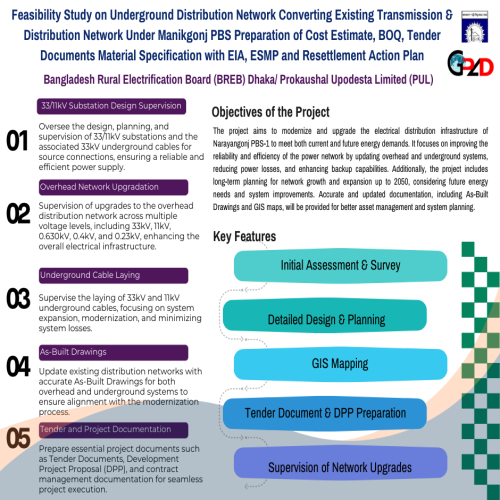 |
|
| Selection of Consulting Firm (National) for Project Implementa-tion Consultant (PISC) for Upgradation and Extension of Power Distribution System Project in Monpura Islands | 2023 | Ongoing | ["Power & Energy Sector"] |
The primary goal of this objective is to appoint an Implementation & Supe PISC) to oversee the monitoring, supervision, and documentation preparation of distribution networks, as well as the surveying of suitable locations for installing submarine cables and optical fiber communication links across the channels of Kolatoli Char, Kazir Char, and Dhal Char. The Project Implementation & Supervision Consultant (PISC) will be responsible for detailed surveying, planning, engineering, designing, and supervising the construction and renovation works, including the testing and commissioning of 11 kV, 11/0.4kV, 0.4kV, and 0.23 kV overhead lines, along with 11/0.4kV pole-mounted transformers and a 11 kV AIS Switching Sub-Station. Additionally, the scope includes the laying of 11 kV submarine cables in the Monpura Upazilla under the "Up-gradation and Extension of Power Distribution System in Monpura Islands" Project. The consultant must visit these islands and chars to review the WZPDCL's records related to distribution lines and sub-stations, ensuring the adequacy and completeness of the information. They will verify in the field whether the WZPDCL's findings are still valid, and if found inadequate, they will reassess and re-survey the facilities to determine the actual required works. Based on this survey, the consultant will prepare detailed planning and sketch drawings using AutoCAD, showing the planned system for new construction and renovation on each char and island within the Monpura Electric Supply. During the execution of consultancy services, the consulting firm must have appropriate logistics, including transport and office accommodation with adequate space for meetings with WZPDCL representatives, computers, office furniture, communication facilities, and necessary manpower. They must also be equipped with essential tools such as Meggers, Clamp on Meters, Voltmeters, Power Factor Meters, Earth Testers, Survey Equipment, and Measuring Instruments to execute the assignment effectively.</p> |
WZPDCL (West Zone Power Distribution Company Limited) | WZPDCL (West Zone Power Distribution Company Limited) | native |  |
|
| Purchase of Digital UAV Images, Data Processing through Geographic Information System (GIS) | 2022 | Completed | ["Power & Energy Sector"] |
The main objective is to acquire high-resolution digital UAV images and proce phic Information System (GIS) technology to generate accurate geospatial data. This data will be used for detailed mapping, planning, and analysis of the project area. The project aims to provide stakeholders with essential information to support infrastructure development, environmental monitoring, and land-use planning.</p> |
NRECA International | NRECA International | foreign |  |
|
| Capture and Process of UAV Imagery | 2021 | Completed | ["Power & Energy Sector"] |
The primary objective is to capture and process high-resolution UAV imagery f and analysis. The project aims to provide detailed, up-to-date geospatial data to support infrastructure planning, environmental monitoring, and land-use analysis, ensuring informed decision-making and efficient project execution.</p> |
NRECA International | NRECA International | foreign |  |
|
| SSC Rangpur Division 99 Batch | 2024 | Completed | ["Database, ICT & System Management"] |
The SSC Rangpur Division 99 Batch Member Directory Website is designed to ser e platform for members of the 99 batch to connect, share updates, and stay informed about various events and activities. The website allows for member registration, approval by an admin, and access to a user dashboard. Once registered and approved, members can log in to view news, events, notices, and blogs shared by other members.</p> |
SSC Rangpur Division 99 Batch | SSC Rangpur Division 99 Batch | native |  |
|
| Travel’n GO Website | 2024 | Completed | ["Database, ICT & System Management"] |
The primary objective of this project is to develop a dynamic and user-friend r and travel company. The website will showcase travel packages, enable online bookings, and provide comprehensive information about various destinations. The goal is to create an engaging platform that enhances the customer experience, increases online visibility, and drives business growth.</p> |
Travel’n GO Client | Travel’n GO | native |  |
|
| E-Voting System for the Department of Environment Officers Association | 2024 | Completed | ["Database, ICT & System Management"] |
The primary objective of this E-Voting System is to provide a secure, transpa platform for conducting elections across various sectors. By leveraging modern technology, the system aims to simplify the voting process, ensure fairness, and deliver instant results. This solution is designed to accommodate the needs of different user groups while maintaining the integrity of the voting process.</p> |
Election Commission Office, Department of Environment | Election Commission Office, Department of Environment | native | 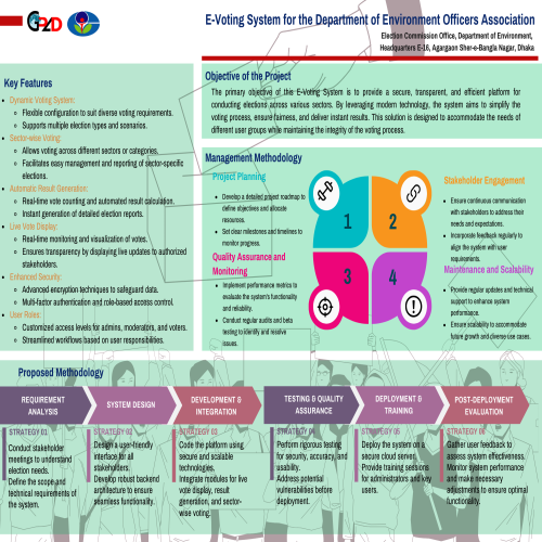 |
|
| ITC Alumni Association Bangladesh (IAAB) Website | 2024 | Completed | ["Database, ICT & System Management"] |
The ITC Alumni Association Bangladesh (IAAB) Member Directory Website is desi omprehensive platform for members of the IAAB to connect, share updates, and stay informed about various events and activities. The website allows for member registration, approval by an admin, and access to a user dashboard. Once registered and approved, members can log in to view news, events, notices, and blogs shared by other members.</p> |
ITC Alumni Association Bangladesh (IAAB) | ITC Alumni Association Bangladesh (IAAB) | native | 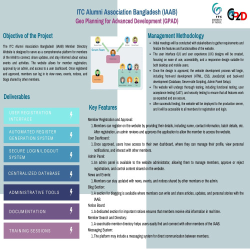 |
|
| eHMS Sytstem for Astha Paribarik Health Clinic | 2025 | Completed | ["Database, ICT & System Management"] |
The objective of the eHMS (Astha Paribarik Health Clinic ) is to create a com zed, and secure platform to manage all hospital operations efficiently. This system replaces traditional manual workflows with an integrated solution that ensures real-time data access, improved communication, enhanced patient care, and streamlined administrative processes.</p> |
Astha Paribarik Health Clinic | Astha Paribarik Health Clinic | native | 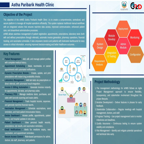 |
|
| Teesta Social Welfare Foundation (TSWF) Website | 2025 | Completed | ["Database, ICT & System Management"] |
|
Teesta Social Welfare Foundation (TSWF) | Teesta Social Welfare Foundation (TSWF) | native | 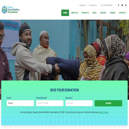 |
|
| Socio-Economic & other Related Surveys for A Pilot Project on Preparation of Comprehensive Development Plan for Nine Upazilas (Revised 10 Upazila) (1st Revised) (Lot 3) | 2025 | Ongoing | ["Urban Planning and Design"] |
Pilot Project on Preparation of Comprehensive Development Plan for Nine Upazi ila) (1st Revised) (Lot 3) </p> |
Urban Development Directorate (UDD) | Urban Development Directorate (UDD) | native | 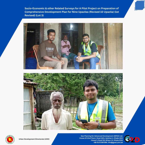 |
|
| Socio Economic and Other Related Surveys under Preparation of Development for 3 Upazilas (Pirajpur Sadar, Nesarbad and Nazirpur Upazilas) of Pirajpur District. | 2025 | Ongoing | ["Urban Planning and Design"] |
This project aims to conduct comprehensive socio-economic and related trong> to support the preparation of <strong>integrated development plans</strong> for Pirojpur Sadar, Nesarbari, and Nazirpur Upazilas.</p> |
Urban Development Directorate (UDD) | Urban Development Directorate (UDD) | native | 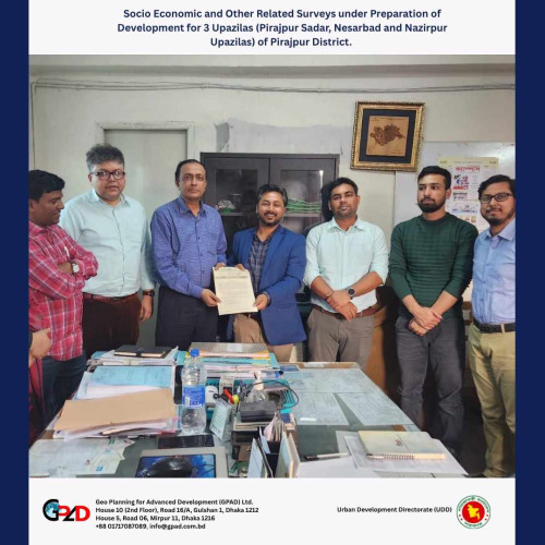 |
|
| Socio-Economic & other Related Surveys for A Pilot Project on Preparation of Comprehensive Development Plan for Nine Upazilas (Revised 10 Upazila) (1st Revised) (Lot 4) | 2025 | Ongoing | ["Urban Planning and Design"] |
This project focuses on conducting detailed socio-economic and relate s part of a <strong>pilot initiative</strong> to prepare a <strong>Comprehensive Development Plan (CDP)</strong> for ten selected upazilas under Lot 4.</p> |
Urban Development Directorate (UDD) | Urban Development Directorate (UDD) | native | 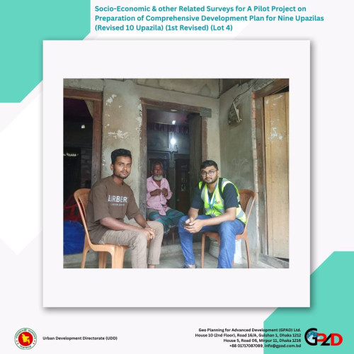 |
|
| Construction of the Department of Military Lands and Cantonments and MEO Central Circle, Dhaka office complex | 2025 | Ongoing | ["Architectural Engineering Solution"] |
This project involves the construction of a modern office complexMore the <strong> Department of Military Lands and Cantonments and MEO Central Circle, Dhaka office complex.</strong></p> |
Department of Military Lands and Cantonments, Ministry of Defence | Department of Military Lands and Cantonments, Ministry of Defence | native | 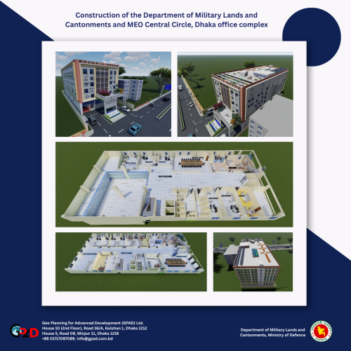 |
|
| Develop one module and facilitate training on gender-sensitive disaster response to representatives of youth girls, CPP representatives, and UDMC member-EmPower-II | 2025 | Completed | ["Training and Capacity Building"] |
Under the EmPower-II Project, this initiative aims to |
Manusher Jonno Foundation (MJF) | Manusher Jonno Foundation (MJF) | native |  |
|
| Topographic Survey and Preparation, Submission and Implementation of Land Acquisition Plan (LAP) For Subprojects. Scrdp-S&I-8 (Package 8) under Southern Coastal Region Development Project (SCRDP) | 2025 | Ongoing | ["Engineering \/ Digital Survey"] |
Topographic Survey and Preparation, Submission and Implementation of Land Acq For Subprojects. Scrdp-S&I-8 (Package 8) under Southern Coastal Region Development Project (SCRDP)</p> |
Local Government Engineering Department (LGED) Nippon Koei Co., Ltd. | Local Government Engineering Department (LGED) Nippon Koei Co., Ltd. | native | 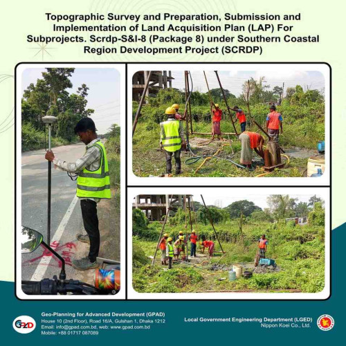 |
|
| Topographic Survey, Sub-soil Investigation and Preparation | 2025 | Ongoing | ["Engineering \/ Digital Survey"] |
For Additional Topographic Survey, Sub-soil Investigation and Preparation, Su mentation Land Acquisition Plan (LAP) of SubProjects MO-P-LR1, MO-P-RB11, MO-U-LR1, MO-U-SW1, MO-U-RB19 and MO-O-RB* under Package No. SCRDP-S&I-22 under Southern Coastal Region Development Project (SCRDP)</p> |
Local Government Engineering Department (LGED) Nippon Koei Co., Ltd. | Local Government Engineering Department (LGED) Nippon Koei Co., Ltd. | native | 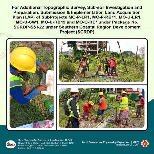 |
|
| Consultancy on Costed Plan on Prioritized activities of CCGAP for Ministry of Environment, Forestry and Climate Change (MoEFCC) | 2025 | Ongoing | ["Climate Change and Disaster Management, Environment"] |
Plan on Prioritized activities of CCGAP for Ministry of Environment, Forestry (MoEFCC)</p> |
Christian Commission for Development in Bangladesh (CCDB) Ministry of Environment, Forestry and Climate Change (MoEFCC) | Christian Commission for Development in Bangladesh (CCDB) Ministry of Environment, Forestry and Climate Change (MoEFCC) | native | 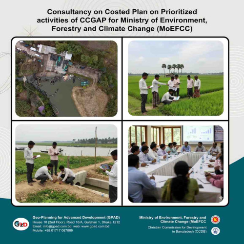 |
|
| Contracting a firm/company to Deliver Capacity Building Programme for BBS Officials | 2025 | Ongoing | ["Training and Capacity Building"] |
Contracting a specialized firm to design and deliver a comprehensive capacity for BBS officials, focusing on improving technical skills, data management, and overall institutional effectiveness.</p> |
United Nations Development Program (UNDP) | United Nations Development Program (UNDP) | native | 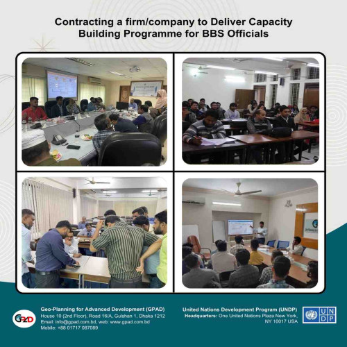 |
|
| Developing One Module and Facilitating Training on Gender Responsive Climate Change Adaptation and Mitigation Empower ll | 2025 | Completed | ["Training and Capacity Building"] |
Developed a training module and facilitated sessions on Gender-Responsive Cli on and Mitigation under the EMPOWER II programme.</p> |
Manusher Jonno Foundation (MJF) | Manusher Jonno Foundation (MJF) | 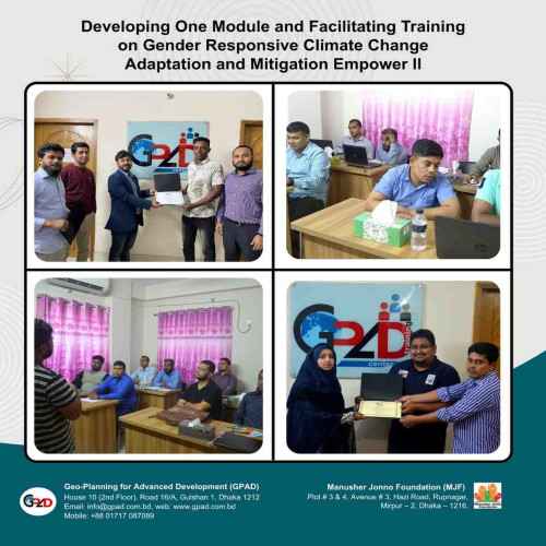 |
||
| Conducted soil testing and a detailed topographic survey of the BCCP 5-katha land to support site assessment and future development planning. | 2025 | Completed | "[\"Engineering \\\/ Digital Survey\"]" |
Conducted soil testing and a detailed topographic survey of the BCCP 5-katha assessment and future development planning.</p> |
Bangladesh Center for Communication Programs (BCCP) | Bangladesh Center for Communication Programs (BCCP) | native |  |
|
| GIS Mapping Support for Toilet Master Plan | 2025 | Completed | ["Geographic Information System (GIS)"] |
Provided GIS mapping support to develop the Toilet Master Plan, including spa nd map preparation for planning and decision-making.</p><p> </p> |
BHUMIJO | BHUMIJO | native | 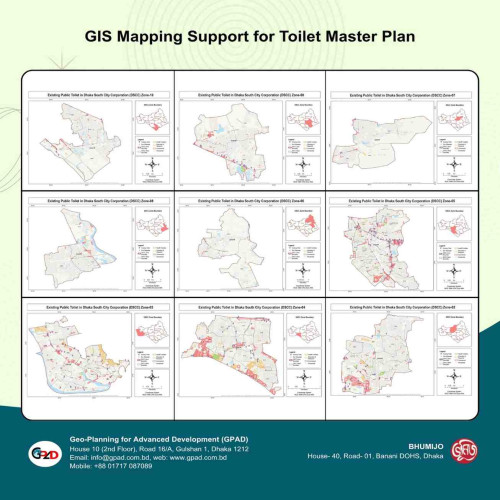 |
|
| Consultancy Service for Master Plan of Sherpur Government College, Sherpur | 2025 | Ongoing | ["Geographic Information System (GIS)"] |
Provided consultancy services for developing the Master Plan of Sherpur Gover ding site analysis, planning, and design recommendations for future development.</p><p> </p> |
Sherpur Government College, Sherpur | Sherpur Government College, Sherpur | native | 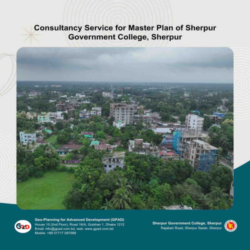 |